Changing two lanes into four lanes on a 48-mi. (77 km) stretch and constructing 69 bridges is no easy task.
This massive project along the Wisconsin 26 corridor was broken into eight segments, stretching from the Interstate 90 intersection at Janesville, on the southern end of the project, north to the Wisconsin 60 east intersection north of Watertown. Wisconsin 26 is an important route connecting communities and major highways in Rock, Jefferson and Dodge counties in the south central part of the state.
It is designated as a long-truck route in the National Highway System and as a connector route in the Wisconsin Department of Transportation’s (WisDOT) State Highway Plan 2020. Under the plan, connector routes are given higher priority funding since they connect major regions and economic centers, according to information from the WisDOT.
About half of the expansion will be constructed alongside the existing corridor. The other half, mainly the bypasses, will be constructed on a new location. Bypasses will be constructed around Milton, Jefferson and Watertown, with interchanges providing easy access to the cities.
The planned improvements are expected to increase capacity, improve safety and maximize economic development potential.
Several of the eight segments on this $325 million project have been completed at various points along the 48-mi. stretch since work began in 2008. The most recently completed segment was completed in the fall of 2012, while another segment is about half complete, and a final segment is to begin this spring.
Segment 3 is well underway, having begun in 2012, with completion set for 2014.
The nearly $53 million Segment 3 consists of constructing a Wis. 26 bypass around the east side of the city of Milton, which is on the southern end of the 48-mi. stretch, on new alignment from Town Line Road to north County Trunk Highway N. From there, Wis. 26 will be reconstructed along the existing highway corridor to the south interchange into the city of Fort Atkinson.
The new roadway will extend 10 mi. (16 km) with two lanes in each direction. No access will be allowed in areas where the roadway is on new alignment except at interchanges located at Wis. 59 and County Trunk Highway N.
“This project consists of a four-lane freeway bypass about a half a mile east of the existing State Trunk Highway 26 from Town Line Road to County Trunk Highway N, and expansion of the existing two-lane highway to four lanes from County Trunk Highway N to the South Fort interchange,” said Jeremy Hall, WisDOT project manager, southwest, Madison, East Unit.
“Currently, the segment from Town Line Road to County Trunk Highway N, the Milton bypass, is completely graded and nearly all of the 15 bridges and two retaining walls are complete,” Hall continued. “The paving and gravel will be completed along with tie-ins to the existing highway, and will be completed by the end of this year as scheduled.”
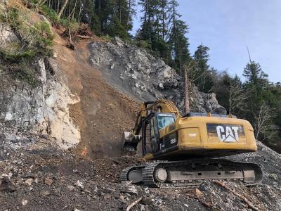
Numerous off-road trucks, backhoes worked to remove the 3.5 million cu. yds. of excavation that included common, rock, marsh and borrow. An additional 1.2 tons (1.1 t) of base course was hauled in and manipulated into place with dozers, compactors and scrapers.
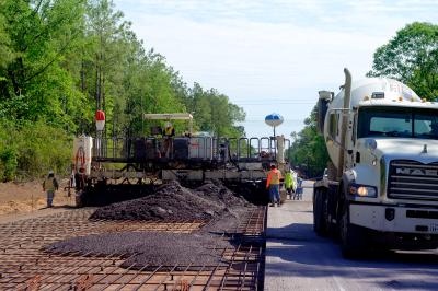
Once paving is complete this year, crews will have placed 66,300 tons (60,146 t) of asphaltic pavement and 360,100 sq. yds. (301,089 sq m) of concrete pavement, using Bidwell equipment.
The project also includes the construction of 17 concrete pre-stressed girder bridges that range in length from 108 to 378 ft. (33 to 1,152 m) and range in width from 36 to 77 ft. (11 to 23.5 m) for a total bridge deck area of 141,770 sq. ft. (13,171 sq m), according to Hall. Cranes of 50 ton (45 t) and 100 ton (90.7 t) were used in the construction.
Bridges are being constructed at Town Line, Storrs Lake and Bowers Lake roads, Whitetail Lane to provide through travel under or over Wis. 26.
Intersection and driveway access will be allowed where the highway is constructed on existing alignment. However, there will be locations where intersection and driveway movements will be limited and where driveway accesses will be combined or moved to a frontage road, according to WisDOT.
The section of existing Wis 26 through the city of Milton will be jurisdictionally transferred to local government when the new bypass is opened to traffic.
Construction of Segment 3 is on time due to dry weather in 2012, good contractors and soils that are predominately sandy, Hall said.
The bypass was actually split into two separate contracts. Rock Road Construction, of Janesville, Wis., was the prime contractor for the grading and structures from Town Line Road to Storrs Lake Road; and, H. James & Sons Construction, of Fennimore, Wis., was the prime contractor for the grading and structures from Storrs Lake Road to County Trunk Highway N and under this same contract the entire bypass will be paved from Town Line Road to County Trunk Highway N.
Much of the project occurred in rural locations so a lot of the challenges that come with the combination of heavy traffic and large construction equipment were avoided, added Mark Vesperman, project manager of WisDOT.
Work on another portion of the corridor, Segment 7, which began in 2009 and was completed in 2012, took place between the village of Johnson Creek and the city of Watertown, a little further north on this corridor. Work consisted of reconstructing 4 mi. (6.4 km) of the existing highway and constructing an 8 mi. (12.9 km) freeway to carry Wis. 26 traffic around the west side of the city of Watertown and north to the intersection with County Trunk Highway Q.
At a cost of $79 million, the highway was expanded to two lanes in each direction. South of the city of Watertown, at-grade side road and driveway intersections remained, although driveways were combined to a single access point or moved to a side road where possible, WisDOT information states. Median crossing points were widely spaced to improve safety, so some intersections and driveways were limited to right in/right out movements. Right turn lanes were added at all side road intersections and left turn lanes were added at each median crossing.
At the south end of the bypass around the city of Watertown, existing Wis. 26 and County Trunk Highway Y were realigned to meet at a new diamond interchange. Another diamond interchange was built on the west side at Wis. 19. At the north end, the existing interchange with Wis. 16 was replaced and Wis. 16 was extended west to a new "trumpet-style" interchange just east of the Provimi and the Welsh Road intersection.
Several bridges were constructed at County Trunk Highways Y, A and T, Welsh Road and Silver Creek Road, which were extended west to Welsh Road. These bridges will provide local traffic crossings over or under, but not onto, Wis. 26. A frontage road was built along the east side of the bypass between County Trunk Highway Y and County Trunk Highway A, including a bridge over the Rock River.
Construction on the final segment, Segment 8, will begin this spring 2013, at a cost of $43 million. Work is expected to be completed in 2015.
Segment 8 consists of reconstructing 6.5 mi. (10.5 km) of the existing highway between County Trunk Highway Q and Wis. 60 East, north of the city of Watertown.
The highway will be expanded to two lanes in each direction. North of the city of Watertown, at-grade side road and driveway intersections will remain, although driveways will be combined to a single access point or moved to a side road where possible.
Median crossing points will be widely spaced to improve safety, so some intersections and driveways will be limited to right in/right out movements. Right turn lanes will be added at all side road intersections and left turn lanes will be added at each median crossing.
The east leg of Wis. 60 will be rebuilt on new alignment, beginning about three-fourths of a mi. east of the current intersection with Wis. 26. It will connect directly with the west leg of Wis. 60 at the interchange with Wis. 16 and Wis. 60 West. The interchange will be rebuilt as a standard diamond and accommodate traffic in all directions.
Other segments along this 48-mi. (77 km) stretch of Wis. 26 corridor that have been completed included:
• Segment 1, in 2009 at a cost of $5.5 million, included relocation Wis. 59 and County Trunk Highway M and consisted of spot improvements from just south of the County Trunk Highway Y intersection north to Town Line Road. The existing four-lane divided roadway remains. Private driveway accesses onto Wis. 26 were relocated to existing side roads, new frontage roads or new development streets.
• Segment 2, in 2009 at a cost of $5.5 million, included relocating Wis. 59 and County Trunk Highway M and consisted of relocating Wis. 59 about a quarter of a mile south of its present location, to allow space for the construction of an interchange with the Wis. 26 bypass around the east side of the city of Milton.
Improvements started at the current Wis. 26 and St. Mary intersection and extend east back to existing Wis. 59 just prior to the Vickerman Road intersection.
The new Wis. 59 has one lane in each direction with a median to provide room for turn lanes at intersections and the future Wis. 26 interchange. Sufficient real estate will be purchased at this time for future expansion of Wis. 59 to a four-lane highway, information from the Wisconsin Department of Transportation states.
An existing segment of County Trunk Highway M will be realigned starting at Town Line Road and extending north to the newly relocated Wis. 59. County Trunk Highway M will then run west with Wis. 59.
A railroad spur crosses proposed Wis. 59 and will require grade separation bridges. Wis. 59 will go over the railroad.
Roundabouts will be constructed at the Wis. 26 interchange ramp connections to Wis. 59 at the new County Trunk Highway M intersection.
• Segment 4, from 2008 to 2010 at a cost of $20.4 million, consisted of adding two lanes and a median along the existing Wis. 26 Fort Atkinson bypass for 5.5 mi. (8.9 km) from the south interchange to Wis. 89. No access was allowed except at the four existing interchanges. Bridges were constructed at Hoard and Banker roads to provide through travel over Wis. 26.
• Segment 5, from 2008 to 2011 at a cost of $56.6 million, consisted of constructing a 7.5-mi. (12 km) freeway to carry Wis. 26 traffic around the west side of the city of Jefferson. The new highway was expanded to two lanes in each direction.
Three interchanges were constructed, one on the south side of Jefferson, one at U.S. 18 and one on the north side of Jefferson. Bridges were constructed at County Trunk Highway W, County Trunk Highway J, Popp Road, County Trunk Highway N and Jahn Road, to provide through travel under or over Wis. 26.
• Segment 6, in 2010 at $7 million, consisted of reconstructing 2 mi. (3.2 km) of the existing highway between the city of Jefferson and village of Johnson Creek. The new highway will be expanded to two lanes in each direction.
Today's top stories


