


Our Main Office
Construction Equipment Guide
470 Maryland Drive
Fort Washington, PA 19034
800-523-2200
Mon December 24, 2012 - Southeast Edition
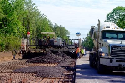
GULFPORT, Miss. (AP) Construction could be delayed for a road connecting the Mississippi State Port of Gulfport to Interstate 10.
The Sun Herald reported Nov. 26 that a federal judge has revoked the Mississippi Department of Transportation’s federal permit to build the northern end of the road.
MDOT had planned to create a conservation area by using 1,600 acres near the interstate, as a trade-off for filling 162 acres of wetlands to build the road.
However, U.S. District Judge Sul Ozerden found the U.S. Army Corps of Engineers acted “arbitrarily and capriciously” in issuing permits. He revoked the permit to MDOT and told the Corps to conduct a new environmental review before issuing any other permit.
State and local officials have said it’s important to have a new road connecting the port with I-10 to help ease the transport of goods coming and going from the expanding port.
Ozerden’s ruling came in a lawsuit filed by a company that owns about 1,300 of the 1,600 acres MDOT wants to acquire through eminent domain. The suit was filed by Ward Gulfport Properties and a company representative, T. Jerard Ward, against the Corps of Engineers.
Ozerden said environmental assessment of the project was based on a different wetlands mitigation plan. Under that plan, MDOT would have bought mitigation credits in other areas to compensate for wetlands loss in the Turkey Creek watershed, a flood-prone area in north Gulfport.
The conservation easement involving the Ward property was offered after the EPA insisted the wetlands be conserved in the Turkey Creek watershed to minimize environmental damage. After the Ward property was substituted as a conservation easement, the Corps approved the permit for road construction, concluding no significant environmental impact would result.
“However, no actual wetlands delineation for this property appears in the record,” Ozerden wrote. “This makes it impossible to determine, based upon the record, whether any wetlands at all are actually being preserved by the permit’s required mitigation and, if so, what the character or quality of those wetlands is, or what the actual mitigation ratio might be.”
Construction Equipment Guide
470 Maryland Drive
Fort Washington, PA 19034
800-523-2200
Construction Equipment Guide covers the nation with its four regional newspapers, offering construction and industry news and information along with new and used construction equipment for sale from dealers in your area. Now we extend those services and information to the internet. Making it as easy as possible to find the news and equipment that you need and want.
Contents Copyrighted 2024, by Construction Equipment Guide, which is a Registered Trademark, registered in the U.S. Patent Office. Registration number 0957323. All rights reserved, nothing may be reprinted or reproduced (including framing) in whole or part without written permission from the publisher. All editorial material, photographs, drawings, letters, and other material will be treated as unconditionally assigned for publication and copyright purposes and are subject to Construction Equipment Guide’s unrestricted right to edit and comment editorially. Contributor articles do not necessarily reflect the policy or opinions of this publication.
Read our privacy policy here.
Mastodon