


Our Main Office
Construction Equipment Guide
470 Maryland Drive
Fort Washington, PA 19034
800-523-2200
Thu June 08, 2017 - West Edition #12
TULSA, Okla. (AP) Cyrus Avery called it his favorite road. To some, it was “the road to nowhere.' Still others felt it should never have been built.
Since 1958, the 3.5-mi., two-lane scenic byway has been known as Avery Drive, named for the man most remembered as the father of the Mother Road, Historic Route 66.
It runs from West 21st Street near Chandler Park to Oklahoma 97 in south Sand Springs.
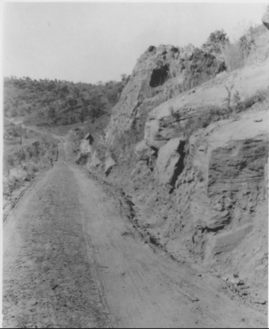
“Idyllic Avery Drive, a hilly, winding riverside road embraced by dense woods and foliage,' is how Tulsa World reporter Manny Gamallo described it in 1990. “To one side is a steep slope broken by occasional rocky bluffs and inviting trails. On the other side, breaks in the trees offer glimpses of a quietly flowing Arkansas River.'
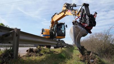
The road is popular with bicyclists and rock-climbing enthusiasts.
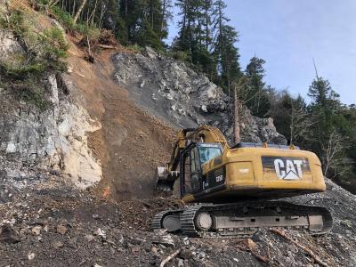
The Tulsa World reported that it has been plagued by numerous landslides and shifting pavement, making it one of Tulsa County's costliest stretches of road to maintain.
In 1990, then-Tulsa County Commissioner John Selph said Avery Drive should never have been built because of unstable rock formations beneath it, but it will never be shut down.
One of the earliest historical accounts of the area was by physician and naturalist Samuel Washington Woodhouse, who accompanied the U.S. Army Corps of Topographical Engineers in 1849 when they were surveying the boundaries of the Creek Nation in Indian Territory.
While camped along the Arkansas River with the surveyors, Woodhouse kept a diary in which he sketched the weathered limestone formation, known locally as Lost City, on the south side of the river.
Avery said the term “Lost City' came from the fact that the massive cliffs looked like buildings.
“In the old days, outlaw gangs used the rocks as a hideout,' Avery told The Tulsa Tribune in 1956.
He said early settlers in wagons had worn trails on either side of the river that were later acquired by the railroads.
“When Red Fork was a pretty good cow town and before Tulsa was thought of, travelers used to ferry across the river and take the trails on which the Frisco and Katy railroads are now built,' Avery said.
Avery was a Tulsa County commissioner when he began building what was then known as the River Road to link Sand Springs and Tulsa. He brought convicts from the Oklahoma State Penitentiary to begin construction in 1914. They started on the Tulsa end only to be blocked by a rock quarry, and work halted in 1915. Avery left office in 1916, and his successor abandoned the project.
For a period, he said, the governor referred to it as the “Whiskey Road' because so many Tulsans traveled the route to Keystone for liquor.
But Avery didn't give up. Twenty years later, he resumed work using labor provided by the Works Progress Administration, a New Deal agency that employed millions of people during the Great Depression. This time, he started on the Sand Springs end.
Again, work halted over right-of-way issues at the site of the quarry where a large stone-crusher operated. “The road to nowhere,' as the Tribune branded the project, was tied up in court for decades because the quarry owner and Tulsa County could not agree on the value of the land.
Finally, 40 years after construction started, the two sides reached agreement and 85-year-old Cyrus Avery got to see his dream road completed in 1956.
But problems were not over for the scenic road.
From 1972 until the early '80s, the old rock quarry was used as a landfill, accepting all manner of solid, liquid and sludge waste, including jet fuel, acids, caustics and solvents.
In 1973, World reporter Ralph Marler and photographer J.R. Jones visited Avery Drive after the county closed it due to dangerous cracks in the pavement. Torrents of discolored, foamy water cascaded from the landfill site and seeped into the road base, acting as a lubricant, Marler reported, and causing part of the road to slide downhill toward the Frisco tracks and the river.
The Environmental Protection Agency in 1988 designated the area as the Compass Industries Superfund site. The EPA completed its cleanup of the site in 1991, delisted it in 2002 and continues monitoring it.
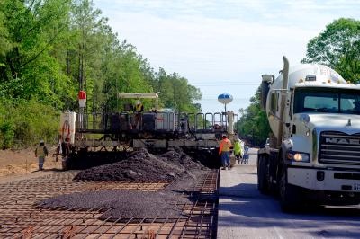
In 2011, Tulsa County laid a fresh coat of asphalt on Avery Drive, at a cost of $700,000.
“I fully expect it to settle again,' said county engineer Tom Rains, “but this fix will hold for a while.'
Construction Equipment Guide
470 Maryland Drive
Fort Washington, PA 19034
800-523-2200
Construction Equipment Guide covers the nation with its four regional newspapers, offering construction and industry news and information along with new and used construction equipment for sale from dealers in your area. Now we extend those services and information to the internet. Making it as easy as possible to find the news and equipment that you need and want.
Contents Copyrighted 2024, by Construction Equipment Guide, which is a Registered Trademark, registered in the U.S. Patent Office. Registration number 0957323. All rights reserved, nothing may be reprinted or reproduced (including framing) in whole or part without written permission from the publisher. All editorial material, photographs, drawings, letters, and other material will be treated as unconditionally assigned for publication and copyright purposes and are subject to Construction Equipment Guide’s unrestricted right to edit and comment editorially. Contributor articles do not necessarily reflect the policy or opinions of this publication.
Read our privacy policy here.
Mastodon