


Our Main Office
Construction Equipment Guide
470 Maryland Drive
Fort Washington, PA 19034
800-523-2200
Tue March 19, 2024 - National Edition
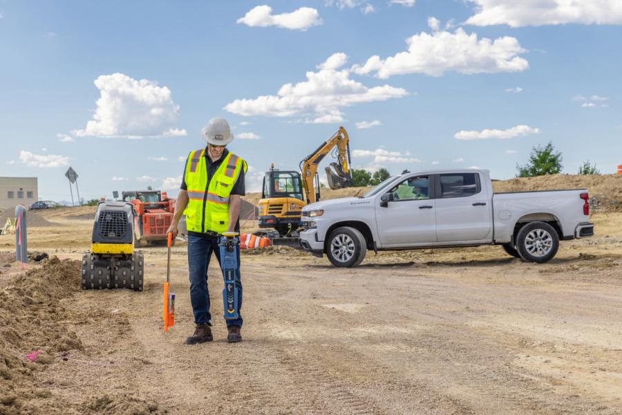
Trimble and Radiodetection announced a collaboration to improve the technology used in the utility measurement and mapping process.
Through the integration of the Trimble Catalyst DA2 GNSS system and Radiodetection's RD Map+ application and precision locator products, the software and hardware integration streamlines utility-locating workflows to provide high-accuracy measurement capabilities for the creation of underground utilities maps in a single field operation.
Traditionally, field technicians manually mark their measurements onsite or rely on data entries to provide to office staff for map creation after a site visit. Data collected with the Trimble Catalyst DA2 GNSS system can now be simultaneously synced with Radiodetection RD Map+ and precision locators that find and mark buried utilities. By streamlining this connection, workers can efficiently and accurately digitize utility-line locations and reduce costly reporting errors.
"Accurate geolocation is critical to the operation and maintenance of underground utilities and public infrastructure," said Stephanie Michaud, strategic marketing manager, Trimble Surveying & Mapping Field Solutions. "By adding survey-grade capabilities to existing utility workflows, this collaboration creates a connected solution that provides confidence and reliability during the data capture process."
This integration advances utility measurement workflows by giving workers the capability to accurately represent the utility asset in a digital format. This streamlines the operation, maintenance and construction process whenever utilities are involved.
"We are excited to bring to the market this solution alongside Trimble as part of the Radiodetection ‘Map It Your Way' initiative," said Tom Turner, product management and marketing director, Radiodetection. "The Map It Your Way initiative is launching a range of solutions combining our latest digitally-enabled hardware with mobile applications to allow customers to accurately map underground utilities."
Trimble Catalyst DA2 GNSS solutions are available through Trimble Geospatial Distribution Partners.
Trimble Catalyst GNSS solutions also are available through the Radiodetection Distributor Network alongside Radiodetection's precision locators and RD Map+.
For more information, visit https://geospatial.trimble.com/en/products/software/trimble-catalyst and www.radiodetection.com/en-us/products/precision-cable-locator-range.
Construction Equipment Guide
470 Maryland Drive
Fort Washington, PA 19034
800-523-2200
Construction Equipment Guide covers the nation with its four regional newspapers, offering construction and industry news and information along with new and used construction equipment for sale from dealers in your area. Now we extend those services and information to the internet. Making it as easy as possible to find the news and equipment that you need and want.
Contents Copyrighted 2024, by Construction Equipment Guide, which is a Registered Trademark, registered in the U.S. Patent Office. Registration number 0957323. All rights reserved, nothing may be reprinted or reproduced (including framing) in whole or part without written permission from the publisher. All editorial material, photographs, drawings, letters, and other material will be treated as unconditionally assigned for publication and copyright purposes and are subject to Construction Equipment Guide’s unrestricted right to edit and comment editorially. Contributor articles do not necessarily reflect the policy or opinions of this publication.
Read our privacy policy here.
Mastodon