


Our Main Office
Construction Equipment Guide
470 Maryland Drive
Fort Washington, PA 19034
800-523-2200
Thu December 08, 2022 - Southeast Edition #25
Three parishes just northwest of New Orleans are perilously situated between the Mississippi River and Lake Pontchartrain. When hurricanes visit the area, as they regularly do, the 60,000 residents of St. Charles, St. John the Baptist and St. James parishes head for higher ground.
Though the river threat has been lessened by a series of levees, the communities remain vulnerable to the inundating hazard of wind-pushed water from the lake. The U.S. Army Corps of Engineers now is working to alleviate the lake threat through construction of a series of levees, flood walls and pumps. The years-long task is daunting.
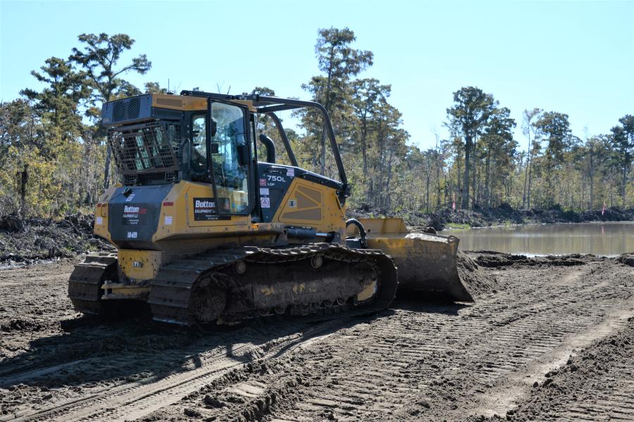
"One of the interesting things about the project is that we are building a levee in a swamp," said Bradley Drouant, civil engineer and manager of what the Corps of Engineers calls the West Shore Lake Pontchartrain project. "It is an incredible and challenging undertaking. The levee is being built in an area of weak soils that nothing has been built on before. It's a unique challenge for us."
The wetlands become a flood zone when hurricane counterclockwise winds push up against the southwest side of the lake and send sheets of water into the adjacent marsh and residential areas beyond. This surge often occurs after frontal winds of the hurricane have passed, so the area is battered twice, by wind and then by water.
The Corps project eventually will shelter the area from the water by constructing 18 mi. of levees and flood walls. The structures will ramble north and then west, effectively separating threatening lake waters from the populated and built-up parishes.
Sounds like a simple fix. It isn't.
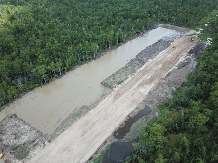
The swamp through which the U.S. Army Corps of Engineers will construct levees is a combination of privately owned land and similar water-saturated property controlled by the Louisiana Department of Wildlife and Fisheries. The land generally features 1 ft. to 1.5 ft. of water and thick stands of deciduous trees, primarily cypress.
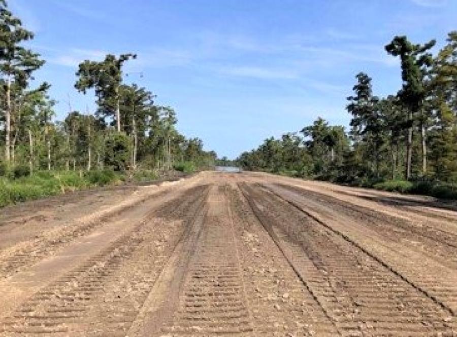
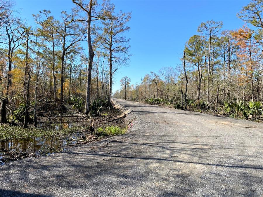
Because the path laid out for the levees and walls is a mile or more from a highway, the proposed work sites were virtually inaccessible. To bring in people and equipment to build the levees, roadways were first constructed.
A total of 12 mi. of access roads were formed. Crushed limestone was laid on a heavier base to bring the surface of the road 4 or 5 ft. above standing water — hence, their description as "land bridges." That phase of the site preparation alone cost $13 million.
Heavy equipment then was brought in — mostly dozers and excavators, some of the latter riding on oversized tracks to allow the machinery to traverse the saturated ground through standing water. A preliminary 100-ft.-wide path was cleared of trees, with the timber burned and stumps uprooted. Ultimately a path 400 to 500 ft. wide will be cut through the virginal cypress forest.
Levees will be constructed in three stages over six to nine months to ensure complete settling of the soils hauled to the project. The levees will vary in width at the base — from 120 to 200 ft. wide, depending on soil conditions — and the first stage will rise 6 ft. Another 6 ft. will be added in a second stage and that will be capped with a final 1.5 ft. of dirt in a third construction stage. The 13.5-ft.-tall levee actually will be stepped down the farther west it runs, with the final section just 8.5 ft. high.
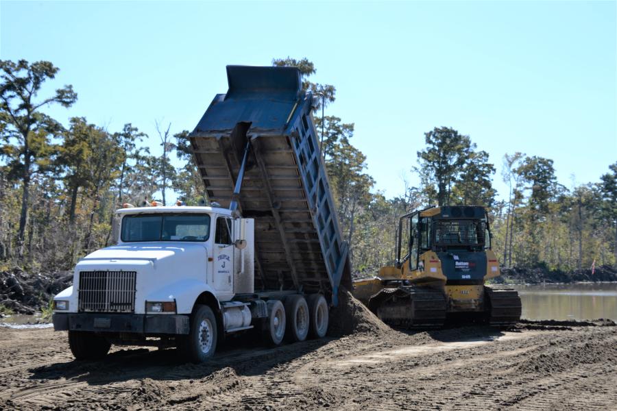
In all, some 6 million cu. yds. of earth will be trucked in to form the levees, a quarter of which will come from government-owned borrow pits. Two 2,000-cfs pump stations also will be constructed and installed.
A 300-ft.-wide sand base is first being laid. Then a thick layer of clay will be spread and fill dirt dumped atop that. The first 3 mi. of sand work has begun, contracted to Phylway Construction of Thibodaux, La.
Because the soil upon which the levee will be built is saturated with water, it is unstable and prone to settling over time. To firm up the base, wick drains are being inserted — a total of more than 10 million linear ft. of drain. The vertical engineered drains are 4 in. wide with very narrow synthetic wicks encased in textile fabric that in turn is sheathed in long, hollow rectangular tubes. They are driven into the ground to various depths, anchored and the top end of the wick is laid on the surface of the sand layer.
The water is collected through the drains and drawn to the surface by the wicks, where it can be drained away from beneath the clay fill. The result: Soil beneath the levee is firmed and stabilized.
"We're not anticipating any problems with the sand and drain work," said Drouant, a 13-year employee of the Corps.
Concurrent with the levee construction will be excavation and forming of 46-ft.-wide canals. They will function as a drainage structure for the area after normal rains but will be gated off during a hurricane to prevent flooding.
The levee, flood wall and canal construction work will proceed simultaneously along the length of the project.
"We anticipate almost all of it will be under construction at the same time with contractors set up to meet at specific locations," Drouant said.
Assigned segments of construction are being worked out, but there will be about a dozen sections in all.
Three other segments on the west end of the project have been farmed out to the state of Louisiana, though they are being designed according to Corps of Engineers specifications. The state was given responsibility for them because the structures are within the scope of a separate construction project to revitalize Maurepas Swamp, which borders the West Pontchartrain target area.
Because of Mississippi River levees and urban development, Maurepas Swamp has been deprived of oxygenated water it once received from the river during flood stages. To mitigate that, a rip-rap-lined canal is being constructed. Through it, diverted river periodically will be directed to the swamp to replenish it with oxygenated water, sediment and nutrients.
"Our project coincided with the diversion project, so it only made sense for the state to oversee the levees situated nearest its project," Drouant said.
The diversion undertaking has been designated part of the project's environmental mitigation.
There are two reasons the Corps isn't constructing an unbroken levee for 18 mi., which is a simpler undertaking. First, utility lines intersect the path of the project. They cannot be run under an earthen levee because that potentially weakens the structure by introducing the possibility of washouts.
Where a utility line intersects, a T-wall will be constructed instead. The wall will be just shy of 18 ft. in height. It is a concrete structure in the shape of an inverted T with a concrete foundation extending out each side, metal sheet piling extending into the ground, and H-pile beams embedded in the soil at angles to stabilize and anchor the wall.
A second usage of T-walls is where the flood protection structure passes under already elevated sections of Interstates 10 and 55. Building a levee in those situations is impossible.
"The challenge of working under an interstate highway is interesting because the work can't interfere with the operation of the interstate," Drouant said. "Just building retaining structures under there to dry out the area is a challenge."
The highway work is critical because the roadway is an evacuation route in hurricanes for the New Orleans metro area. During Hurricane Isaac in 2012, I-10 was submerged for several days, hampering emergency response to the situation. The wall-levee barrier is expected to reduce flooding for the most vulnerable segment of the highway.
The whole levee-wall project is scheduled to be complete sometime in 2026 at a cost of $760 million. Earthmoving and construction should continue year-round, with spring and early fall months being optimum work periods.
Drouant said work slows in the winter but continues.
"There are more productive times and less productive times."
In the end, the project is advertised to create a "100-year risk reduction" in flooding of the area, but the U.S. Army Corps of Engineers is trying to get away from such descriptions. The 100-year concept logically leads lay people to conclude that a century will pass between big-time flooding. More accurately, Drouant said, the levee system is designed so that there is just a one percent possibility in any given year of a storm occurring that is greater than what the levees and walls can withstand.
Drouant was asked if he has encountered any surprises so far.
"There always are surprises, but I think we have done a good job of working through them."
For instance, the Corps expected to handle some of the utility pipe intersections by directional drilling beneath the levee walls. That proved unwise because of the absence of an adequate sand layer. Drilling through clay can lead to destabilizing fractures.
Drouant said other challenges being overcome by engineers and contractors include building in a wet environment, dealing with the interstate and building the entire system simultaneously instead of piecemeal.
"In the past, the Corps wouldn't have all of this going on at once. But with Congress funding it all upfront, we are able to build it at the same time. Sequencing the work has been a challenge."
Project contractors work under the same mantra as the medical profession — first, do no harm. In this case, that means ensuring that during construction, the work sites will maintain channels for normal drainage.
"We don't want to cause any flooding," Drouant said.
Finally, there is the issue of duck hunting. The marshy acreage naturally attracts fowl, which in turn attract hunters. The Louisiana Department of Wildlife and Fisheries has established hunting locations within the work area.
"That's not typically something we have to worry about," said Drouant, "but we must coordinate with any duck-hunting going on in the area to keep a safe workplace."
The project will provide a new level of protection to the 60,000 people living in these parishes. They are subject to battering and flooding from every hurricane that comes along. Weathering such storms is not an abstraction to Drouant: he was born and raised in this region of Louisiana.
"The thing I love about the project and makes me feel good about coming to work every day is that this will make a real difference in their lives. We'll have a few more hurricane seasons to get through while were working on this, but eventually they are going to have so much more risk reduction than they've had in the past. It will be a whole different level of protection than the sandbagging they've done before." CEG
Construction Equipment Guide
470 Maryland Drive
Fort Washington, PA 19034
800-523-2200
Construction Equipment Guide covers the nation with its four regional newspapers, offering construction and industry news and information along with new and used construction equipment for sale from dealers in your area. Now we extend those services and information to the internet. Making it as easy as possible to find the news and equipment that you need and want.
Contents Copyrighted 2024, by Construction Equipment Guide, which is a Registered Trademark, registered in the U.S. Patent Office. Registration number 0957323. All rights reserved, nothing may be reprinted or reproduced (including framing) in whole or part without written permission from the publisher. All editorial material, photographs, drawings, letters, and other material will be treated as unconditionally assigned for publication and copyright purposes and are subject to Construction Equipment Guide’s unrestricted right to edit and comment editorially. Contributor articles do not necessarily reflect the policy or opinions of this publication.
Read our privacy policy here.
Mastodon