


Our Main Office
Construction Equipment Guide
470 Maryland Drive
Fort Washington, PA 19034
800-523-2200
Tue July 10, 2007 - National Edition
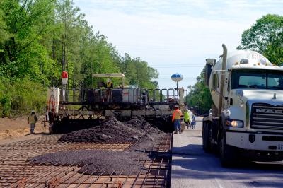
Caterpillar’s AccuGrade Compaction for soil compactors, is a compaction solution that delivers precise GPS mapping and soil compaction measurement capabilities. This new compaction measurement and mapping system provides the operator, contractor and project owner with a number of benefits that increase production and simplify job site documentation, according to the manufacturer.
A color display shows the operator a map of the working area and includes critical compaction data, such as working speed, amplitude, frequency, compaction values and number of passes.
The compaction values are displayed as a graduated color scale that is calibrated to match the characteristics of the soil being compacted. A target compaction value is displayed as a certain color. When the value colors match the target value color, the operator can move on to the next work area, taking the guesswork out of determining when the job is completed.
Other data can be displayed as needed, such as a coverage map that shows the number of passes completed, which helps the operator verify that the work is done. The single display is easy to use and its position can be adjusted to meet operator preferences.
The contractor will benefit from increased production through efficient utilization of manpower because the operator will be able to determine when the work has been completed, working areas that need more compaction and getting off areas that meet specifications. The optimized manpower utilization results in fewer passes and reduced fuel use to get the same amount of work done. The ability of the operator to view compaction data in real time will help identify compaction problems so that they can be fixed early in the construction process, according to the manufacturer.
Project owners will benefit from the electronic data generated during the compaction process. The values can be viewed and analyzed on the job site or back at the office.
This capability provides documentation in the form of a historical record of work completed, with the compaction values and pass information correlated to positions determined by GPS. The ability to document the work completed can reduce the number of traditional compaction tests needed, reducing costs and improving safety for test and inspection personnel.
Construction Equipment Guide
470 Maryland Drive
Fort Washington, PA 19034
800-523-2200
Construction Equipment Guide covers the nation with its four regional newspapers, offering construction and industry news and information along with new and used construction equipment for sale from dealers in your area. Now we extend those services and information to the internet. Making it as easy as possible to find the news and equipment that you need and want.
Contents Copyrighted 2024, by Construction Equipment Guide, which is a Registered Trademark, registered in the U.S. Patent Office. Registration number 0957323. All rights reserved, nothing may be reprinted or reproduced (including framing) in whole or part without written permission from the publisher. All editorial material, photographs, drawings, letters, and other material will be treated as unconditionally assigned for publication and copyright purposes and are subject to Construction Equipment Guide’s unrestricted right to edit and comment editorially. Contributor articles do not necessarily reflect the policy or opinions of this publication.
Read our privacy policy here.
Mastodon