


Our Main Office
Construction Equipment Guide
470 Maryland Drive
Fort Washington, PA 19034
800-523-2200
Fri May 25, 2018 - Northeast Edition #11
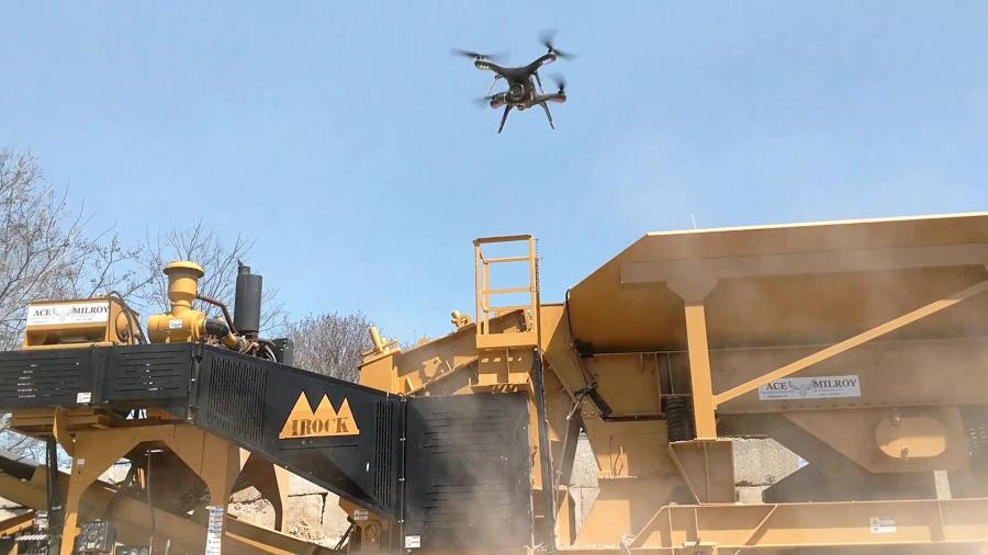
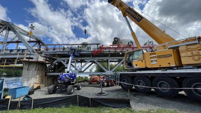
Ace Equipment Sales Inc. of Willington, Conn., has embraced drone technology in a big way. Information gathered from drones is being used in new plant design, plant remodeling, reclamation projects, stockpile reviews, purchase decisions and permitting applications for customers in New England and New York.
Like other people, Ace Equipment initially used drones for taking interesting photographs and video of equipment, sites and blasts. There is a lot to be gained from aerial photographs and videos. Operators know the value of photographic information when going before a zoning board or other regulatory bodies. Drones also are excellent tools for videotaping crushing and sorting operations to solve problems such as issues with transfer points.
Ace Equipment has used Autodesk's Inventor Software Environment to design equipment and crushing plants for years. Flying a drone for photographs is just the first step in gathering valuable information to help with crushing plant design and installations.
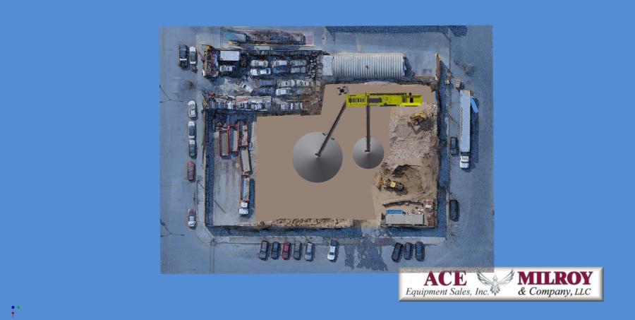
Finding a way to merge the virtual equipment from their Inventor Software Environment with a 3D point cloud of a specific customer site would be a game changer.
Robert Campbell, Ace Equipment's project manager and designer, figured that information gained from drone photography could be the answer they were looking for.
“Sites are never perfectly flat, perfectly square, and without obstructions,” said Campbell. “When designing a custom crushing and screening plant, the correct work area and site topography are so critical to designing a true to life workable plant.”
Using a technique known as photogrammetry, the drone's photographs are used to create topographic surveys of job sites. CJ Knight, who is head of sales, said, “Rather than relying on expensive aerial LiDAR or time consuming terrestrial surveys, flying a drone over your site allows us to rapidly and inexpensively build accurate digital elevation models or point clouds.”
Going one step further, Ace Equipment uses a RTK-GPS (Real Time Kinematics–Global Positioning Satellite) Unit. This RTK-GPS unit provides a precisely fixed ground reference station to reduce and remove common positioning errors. Once everything is merged together, the result is a three-dimensional virtual representation of the mine site property where all sorts of information can be generated and utilized
Knight was enthusiastic about how drones help operators.
“We use drones to generate 3D models of construction sites, quarries and structures. These maps help obtain the 'big picture' and assist in strategic decision making. We can model your site and equipment layout for future upgrades or changes. We can even show you the finished project before you start.”
From this information, one can see how the new plant, including stockpiles, haul roads, generators, control booths are going to fit on your site.
From there, the software can generate a scaled three-dimensional visual proof of concept of the site. Questions like “Is it going to fit? How much material can I store? What size conveyors? How much site work do I need to do?” can be answered quickly, efficiently and correctly. And customers get to see their plants and study them in a virtual site before making a large investment in plant and site development.
Virtual, Accurate Information with Real World Coordinates
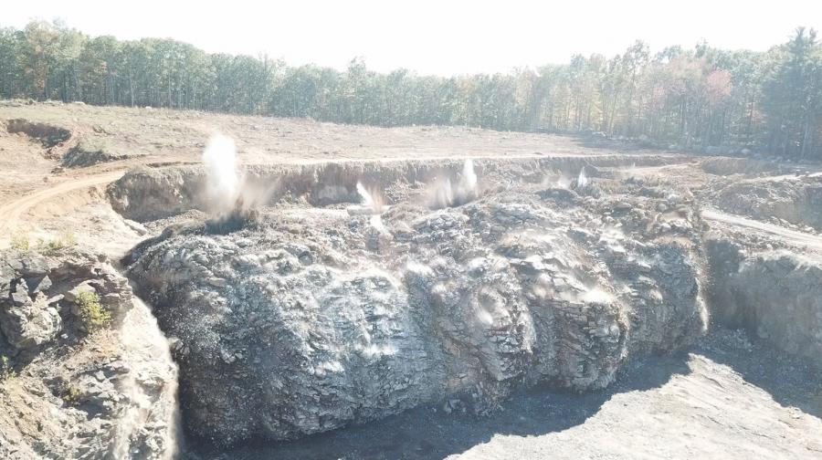
Quarry landscapes are ever-changing so scanning these sites quickly and efficiently gives better, more timely information, for planning, management and reporting purposes. The collected data can be used to plan operations such as the positioning of mining equipment, blast surveying, stockpile inspection and the re-routing of access roads
Quarry owners also are concerned about the quantity of the material being blasted and the stockpile volumes. Most quarries also are required to perform a reclamation of the property after the gravel or stone has been removed. Drone flight photography linked to the proper software can create day of flight information and comparative information from flight to flight for in-house documentation and regulatory reports. The operator can verify how much stone is going out and how much fill is coming in.
In today's world, the thirst for more information is endless. Ace Equipment Sales has taken the next step to create a virtual environment, which can provide that information needed to make better decisions for a more profitable company.
Construction Equipment Guide
470 Maryland Drive
Fort Washington, PA 19034
800-523-2200
Construction Equipment Guide covers the nation with its four regional newspapers, offering construction and industry news and information along with new and used construction equipment for sale from dealers in your area. Now we extend those services and information to the internet. Making it as easy as possible to find the news and equipment that you need and want.
Contents Copyrighted 2024, by Construction Equipment Guide, which is a Registered Trademark, registered in the U.S. Patent Office. Registration number 0957323. All rights reserved, nothing may be reprinted or reproduced (including framing) in whole or part without written permission from the publisher. All editorial material, photographs, drawings, letters, and other material will be treated as unconditionally assigned for publication and copyright purposes and are subject to Construction Equipment Guide’s unrestricted right to edit and comment editorially. Contributor articles do not necessarily reflect the policy or opinions of this publication.
Read our privacy policy here.
Mastodon