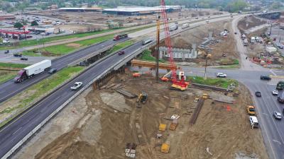
Turning 10 mi. (16.1 km) of Highway 14 from Waseca to Interstate 35 in Owatonna, in southern Minnesota, into a four lane highway and adding bypasses will increase safety and mobility for the 6,500 to 18,200 vehicles that travel this stretch each day.
Population growth has not been excessive but additional truck and commuter traffic has grown, creating safety issues. The existing highway was not built to carry the increased traffic, said Chad Fowlds, construction engineer of the Minnesota Department of Transportation’s Owatonna office.
“So we upgraded the highway to four lanes with the intent of someday having four lanes from New Ulm to Rochester,” said Fowlds. “We made progress on that over the last several decades, and this is one project that gets us to that goal.”
Prior to construction, the highest crash severity was in the city of Waseca, a long community with a large amount of highway within city limits, creating numerous cross streets and intersections. Reconstruction of Highway 14 reduced the number of intersections by restricting access on the new highway within the city and in turn reduced the number of accidents. Now, the only way vehicles can get on and off the highway is on interchanges.
Since this road crossed over all the secondary road systems, minimizing the disruption of the local residents was a primary focus of this $56 million project.
“We wanted to ensure that all the roads weren’t cut off and rerouted with no other option to get across the highway. So we built in some considerations early in the process so the overpasses could be completed a year or two ahead of the final completion,” Fowlds said.
This made it more convenient for locals and fire and rescue. Consideration also had to be made so construction didn’t obstruct the flyway and runway patterns of an adjacent airport.
Other issues of the project occurred because the highway runs through farm ground.
“We needed to make sure farmers could get into farm ground and we needed to enhance farm field drainage,” Fowlds said.
Unstable soil issues caused this project, which began in July of 2008, to take longer than normal to complete. Fowlds explained that some of the soils in this area are soft and when dirt is piled on top it causes the soil to consolidate under the weight. So contractors had to wait, in some cases over a year, for materials to stabilize.
“Even though we get work accomplished early on, the process is spread out because of the time needed to wait for soils to settle so that when we’re building on top of the soils they are stable enough to not settle,” he said.
Because of the soft soils, drainage issues had to be addressed in three ways. Subsurface drainage that was handling field drain tiles needed to be rerouted and perpetuated under the highway.
“We can’t just cut it off and block it.” Fowlds said.
Surface drainage was needed to move water once the road was completed. And a third type of drainage was needed under the roadway to keep the road bed dry and stable.
To aid in drainage, about 2 million linear ft. (609,600 m) of wick drain was installed by prime contractor C.S. McCrossan of Maple Grove, Minn. Installing the wicks is like putting little straws in the ground before the fill to expedite the consolidation. The wicks provide a drainage path for the water to exit the foundation soils; the shorter the path for the water to exit the ground the faster it will consolidate, Fowlds said.
A Derik, mounted on an excavator, was used for installation. The Derik has hydraulic components that push the sleeve into the ground.
“It is like putting in little drains 50 feet deep. The wick comes on a large roll and is pushed in the soil 50 feet and is then cut off. The process is continued until all the soil area is covered. This procedure is often needed in Waseca County due to the condition of the foundation soils,” Fowlds said. “Projects take years rather than months to complete because we don’t want bridges moving and shifting. Monitoring is done during the settlement process by use of settlement plates that are placed in the fill. Survey readings are taken at regular intervals to see how much the embankment is settling; once it is stabilized little movement occurs.”
Allowances are included in the contract so the contractor knows how long officials anticipate the roadway fill will take to reach the proper consolidation level.
“So they had to account for that in their project schedule, as well,” Fowlds said.
About 400,000 cu. yds. (305,822 cu m) of soil correction was required of the very soft peat and nonstructural soils. Soft soils were removed, in most cases 15 ft. (4.6 m) down, but in some cases 30 ft. (9.1 m) down. The deeper soils were fairly localized, while the more shallow digs of 5 to 10 ft. (1.5 to 3 m) deep were fairly long, Fowlds said.
“A lot of the solids could be reused on the outside of the roadbeds but some had to be disposed of in adjacent farm fields,” he added.
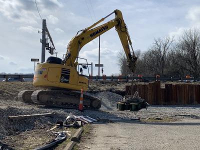
Widening the 10 miles of Highway 14, rebuilding secondary roads that intersect Highway 14 and building and realigning two interchanges at Interstate 35 and three overpasses required 3 million cu. yds. (2,293,665 cu m) of embankment/earthwork, and about 350,000 yds. (320,040 m) of concrete pavement just for the highway segment. Machine control GPS was used to form the embankments. Much of the earth work was moved with large track-mounted farm tractors that pulled wagon-type scrappers. Some backhoes, off road trucks, standard self-propelled scrapers, dozers and motorgraders were also used.
Cool, wet conditions in the spring also caused delays, but by the end of May it was starting to dry up to a point where work could continue.
“With the types of soils we have we need stretches of dry weather to make good progress but there were only a few day of warm weather and the rest were cold and rainy,” Fowlds said.
Crews also waited for frost to come out of the ground and weight restrictions to be lifted so work could begin. Crews kept busy doing minor bridge and pipe work, however.
Six bridges were included within a one-mile (1.6 km) stretch of Highway 14 over two county roads and a railroad, creating a compacted work area. The bridges that carry Highway 14 traffic are 200-ft. (61 m), two-span bridges that have two lanes in each direction with shoulders. Another four brides are scattered throughout the project and are 120-ft. (36.6 m), one-span bridges that are county road overpasses. They include two lanes with shoulders, one in each direction, across the bridge.
CEG
Today's top stories


