


Our Main Office
Construction Equipment Guide
470 Maryland Drive
Fort Washington, PA 19034
800-523-2200
Wed June 22, 2005 - Midwest Edition
It’s a common story: aged, outdated infrastructure can’t keep pace with the increasing population in urban areas.
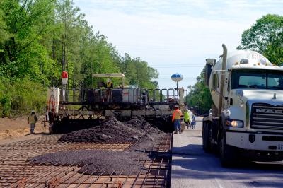
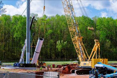
Growth in the Quad Cities has translated into amplified traffic, particularly on the I-74 corridor that spans the Mississippi River. More than 78,000 vehicles traverse the existing twin suspension bridges every day.
The bridges, built in 1935 and 1959, are structurally sound, but understandably require periodic standard maintenance –– everything from painting to concrete repair to replacing light bulbs.
But at 24 ft. (7.3 m) wide with no shoulder, the two-lane structures make basic maintenance and incident management problematic. The biggest problem with maintenance is that, due to the absence of a shoulder, one lane has to be closed to perform work, thus obstructing traffic even more. Incapable of being widened, the bridges pose no solution to the traffic slow-downs and snarls that impede traffic flow.
A 1999 major investment study concluded that capacity improvements are needed on the I-74 corridor. That conclusion led to the I-74 Corridor Study, which began planning late in 2000. Due to the unique nature of this urban area, the Iowa Department of Transportation and the Illinois Department of Transportation have joined forces, and are working closely with the Federal Highway administration, the Army Corps of Engineers, the Environmental Protection Agency, various resource agencies and specialists, an advisory committee and civic officials.
The project is designed to evaluate transportation problems and suggest a range of solutions and recommend a plan to improve traffic flow and mobility along the corridor, as well as provide a functional and aesthetically pleasing bridge while respecting the environment and complementing community plans and goals.
Project engineer/project manager Tammy Nicholson indicated that the group completed the preliminary study phase in October 2003 and presented its concepts and proposed locations at public hearing in December that year.
This phase included a Draft Environmental Impact Statement, which was released for public comment in November 2003 and which will serve as the basis for selection of a recommended solution. Four initial concepts were developed through a series of workshops, where possible river crossing location options, interchange options and lane requirements were identified.
“We know the capacity needs and lane needs of the new bridges,” Nicholson said. “We determined that by 2035 we will need three lanes of traffic in each direction, plus an auxiliary lane for maintenance, repair and emergency situations.”
She added that the Coast Guard has confirmed span requirements for navigational needs, as well as the horizontal and vertical clearance needs. What isn’t known at this point is whether one or two new bridges will be constructed.
“That will be determined during the next phase,” Nicholson said.
No matter how many new ones are going up, the need to leave the existing bridges in place during construction led to proposals to shift alignment of the new bridge (or bridges). From 10 choices of alignment, the preferred alternative plan identified a location east of the existing bridges.
Other work proposed under the preferred alternative plan includes improving interchange design features along the corridor. Some of the interchanges will be reconstructed in a similar style with only minor improvements and slight changes in ramps, but Nicholson said a pair of one-way ramps in downtown Bettendorf, IA, will change significantly.
“The northbound ramp to Iowa is a short, steep ramp over the river that drops down quickly to the street,” Nicholson said. “The proposed change would make Grant Street a two-way street with three lanes of traffic in each direction and a ramp that will be longer and safer.”
In addition, access to I-74 will be consolidated at Grant Street, eliminating current connecting ramps at Kimberly Road and State Street.
“We’ve done a lot of traffic analysis that shows better traffic flow by confining access to Grant Street,” Nicholson said.
The preferred alternative continues to be refined as the group further reviews the environmental impact statement with the Federal Highway administration and awaits preliminary designs and completed environmental studies.
“It’s a very large project,” Nicholson said when asked about a time line. “In major urban areas where you’re dealing with land acquisition requirements, and environmental as well as community impact, it takes time.”
Because this project will cut through the middle of the Quad Cities, it will affect some businesses, particularly when interchanges are altered and connections are eliminated.
According to Nicholson, there have been extensive meetings with the public and with property owners in the corridor to help them understand the alternatives and their impact.
“The community has been very supportive. They recognize the need,” she said.
It’s too early to inform the public of a work schedule. As Nicholson said, “We don’t have the staging figured out yet. There are too many issues to be decided on.”
It’s even too early to identify funding for the work. Without a specific budget, Nicholson said the group doesn’t yet know how much federal funding they’ll receive, but admits that it’s “a major project, with a major cost.”
Opportunities to pursue a pedestrian/bike trail crossing and to initiate traffic/incident management systems will be explored at a later date.CEG
Construction Equipment Guide
470 Maryland Drive
Fort Washington, PA 19034
800-523-2200
Construction Equipment Guide covers the nation with its four regional newspapers, offering construction and industry news and information along with new and used construction equipment for sale from dealers in your area. Now we extend those services and information to the internet. Making it as easy as possible to find the news and equipment that you need and want.
Contents Copyrighted 2024, by Construction Equipment Guide, which is a Registered Trademark, registered in the U.S. Patent Office. Registration number 0957323. All rights reserved, nothing may be reprinted or reproduced (including framing) in whole or part without written permission from the publisher. All editorial material, photographs, drawings, letters, and other material will be treated as unconditionally assigned for publication and copyright purposes and are subject to Construction Equipment Guide’s unrestricted right to edit and comment editorially. Contributor articles do not necessarily reflect the policy or opinions of this publication.
Read our privacy policy here.
Mastodon