Originally called Mission Hill Acres, this suburb of Kansas City, Mo., sits in the extreme northeast corner of Johnson County Kansas and is landlocked by five other communities. It is one of 21 incorporated communities in one of the fastest growing counties in the state of Kansas.
As a result of a Federal Emergency Management Agency (FEMA) study, redrawn floodplain maps placed more than $51 million of its residential and commercial property in the Rock Creek floodplain in Mission alone.
According to Steve Weeks, director of infrastructure for the city of Mission, the city contracted for an engineering feasibility study with Black and Veatch of Kansas City, Mo., and Applied Ecological Services Inc. (AES) of Brodhead, Wis., to evaluate its options.The city also conducted public meetings to solicit input from residents.
The first meetings started in late 2004 and included plan options and funding options, including grants and local sources.
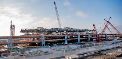
It was during this preliminary evaluation period that the new owners of the Mission Mall, The Cameron Group LLC of Syracuse N.Y., decided to demolish the mall and replace it with an entirely new development called the Gateway Project. When completed in 2008, The Gateway will be 1.3 million sq. ft. of combination residential, retail, hotel and entertainment space, set in a European-style environment. When completed, this project will cost $270 million.
According to Weeks, “The demolition of the mall was an opportunity for the city to broaden the basin improvements through the mall project east.”
By 2005 five proposals were presented to the city for review. In the end the following concepts were implemented for installation:
• Using both an open and boxed-in area with commercial redevelopment on top of the boxed-in areas of the creek.
• Many properties will be purchased by the city to improve the floodplain which keeps the creek as a natural stream and focal point for redevelopment. The plan includes many new businesses, as well as a wide green swath through downtown Mission. This concept allows the floodplain to follow its natural course with redevelopment surrounding it.
• This option essentially keeps the same general layout of Rock Creek as it currently existed with primarily an open channel configuration and box culverts at five street crossings. The improvements at Mission Mall as described in the previous option would remain the same.
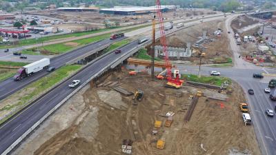
The project also includes street and intersection improvements that cross the project area. These streets and intersections were scheduled for improvements over the next few years, based on the Johnson County Assistance Road System (CARS) project calendar. The CARS program provides funds to the cities of Johnson County to construct and maintain their major arterials. Because of their proximity to the Mission floodplain project, their improvement was coordinated with the floodplain construction thus reducing detours and traffic congestion.
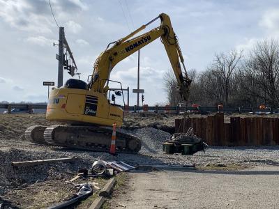
Max Rieke & Brothers Inc. of Shawnee, Kan., and J.M. Fahey Construction Co. of Grandview, Mo., are the principal contractors for this project.
The most prominent feature of Mission that extends the full length of the city from west to east is Rock Creek. The city grew around this stream. The city dates back to the days of the Santa Fe Trail when people traveling west camped in the area because of the clear running springs and streams.
Eventually, homes in early settlements led to small businesses.
While the city of Mission did not expand the floodplain, the floodplain expanded into the city as random growth continued to increase the impervious areas that could not absorb rainfall, leading to uncontrolled runoff and flooding.
Rock Creek adapted but, eventually, property owners along the stream experienced floods. Because the city did not have ownership of the creek and had no jurisdiction over the owners along the creek, it had no control over property owners making random, unsupervised improvements to solve their immediate problems. The result was that, after a few rain events, it became obvious the problem was being pushed downstream to a neighboring property.
When FEMA started its program of mapping all the floodplains in the United States, cities like Mission got their first glimpse at what was defined as a 100-year floodplain.
Initial studies presented the city what improvements it could afford and what properties would require flood insurance. In the 1980s improvements were made along Rock Creek to protect against 100-year floods for some properties such as the improved Mission Shopping Center, but not others.
The Mission Shopping Center was opened in 1956. Originally built as an open air shopping center, the facility was rehabbed in 1989, making it a 350,000 sq. ft. enclosed mall. It was at this time that the city made improvements to Rock Creek to put this area in a 100-year floodplain. The mall operated successfully, but in August 2005 the owners announced its sale, demolition and replacement with a mixed-use development.
After the floods of 1988 the Johnson County Public Works Department conducted a study of the northeast county watershed. The northeast watershed includes 38.5 sq. mi. and contains five watersheds, including Rock Creek. Rock Creek is a small stream that approximately parallels Johnson Drive within its city limits.
The second phase of this project involved the collection of field data on channels, culverts, bridges and low opening elevations on residences and businesses near flood-prone areas. Engineers from the Larkin Group of Kansas City, Mo., collected and analyzed all the data.
The resulting product generated new floodplain maps replacing existing FEMA maps. Additionally, the study provided tools for engineers and city planners to evaluate the impact these flood-prone areas have on redevelopment in the watershed area. This watershed study provided a broader evaluation to potential solutions that was not previously available. CEG
Today's top stories


