


Our Main Office
Construction Equipment Guide
470 Maryland Drive
Fort Washington, PA 19034
800-523-2200
Wed August 22, 2018 - Southeast Edition

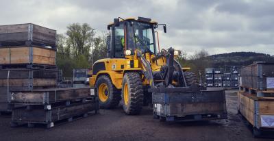
Nearmap, a location content provider, has partnered with the City of Durham, North Carolina, Public Works Department for projects ranging from road maintenance and pothole patching to water sampling and degradation. Using real-time imagery from Nearmap while out in the field, the Public Works Department streamlines data collection, reduces time spent in the field and saves money.
The Public Works Department is tasked with managing all infrastructure data for the city, including mapping the impervious area for the city's $16 million a year Stormwater Utility Fee fund. “That is half a billion square feet of impervious area that we manage through digitization and review daily,” said Edward Cherry, GIS administrator for the City of Durham. “That fund was one of the main drivers in choosing Nearmap.”
After using several satellite imagery systems with low resolution and infrequent captures, Cherry and his staff of 14 GIS professionals determined the city needed far superior quality in their mapping imagery to accommodate the city's growth explosion. Captured every six months at a 2.8-in. GSD, Nearmap now supplies Durham with crystal-clear images that are up-to-date while also allowing accessibility through web-based cloud servers.
With Nearmap, the Durham Public Works Department has achieved:
“Having access to imagery back to 2014, we're able to go back in time during the thrust of development and monitor it forward,” said Cherry. “With Nearmap, we've been able to update development processes and policies to support the revitalization of the downtown district as well as rapid city growth.”
For more information, visit http://go.nearmap.com.
Construction Equipment Guide
470 Maryland Drive
Fort Washington, PA 19034
800-523-2200
Construction Equipment Guide covers the nation with its four regional newspapers, offering construction and industry news and information along with new and used construction equipment for sale from dealers in your area. Now we extend those services and information to the internet. Making it as easy as possible to find the news and equipment that you need and want.
Contents Copyrighted 2024, by Construction Equipment Guide, which is a Registered Trademark, registered in the U.S. Patent Office. Registration number 0957323. All rights reserved, nothing may be reprinted or reproduced (including framing) in whole or part without written permission from the publisher. All editorial material, photographs, drawings, letters, and other material will be treated as unconditionally assigned for publication and copyright purposes and are subject to Construction Equipment Guide’s unrestricted right to edit and comment editorially. Contributor articles do not necessarily reflect the policy or opinions of this publication.
Read our privacy policy here.
Mastodon