The Washington State Department of Transportation (WSDOT) is addressing growing pains in the Redmond, Wash., area with an $82.7 million project.
For some time, the 27,000-plus drivers who travel between downtown Redmond and the Sammamish Plateau along state Route 202 have been experiencing 3 to 5-mi. traffic back-ups every weekday morning and evening.
The congestion is understandable when one considers that Redmond saw 26 percent growth from 1990 to 2000, bringing the population to 45,256.
Approximately 3 mi. southeast of Redmond, the town of Sammamish — which wasn’t even incorporated at the time of the 1990 census — had reached a head count of 34,104 by 2000.
So in November 2004, WSDOT began a project to widen almost 3 mi. (4.8 km) of SR 202. The improvements start at state Route 520, in the commercial sector of Redmond, continue through the edge of Sammamish, and end in a rural area of King County at Sahalee Way Northeast.
An Underground Tangle
WSDOT has divided the project into two phases.
Phase 1, which was completed last summer, cost $10 million and was performed by contractor SCI Inc.
The construction area of Phase 1 consisted of .5 mi. (.8 km) of roadway. An additional lane was added to SR 202 in each direction between SR 520 and East Lake Sammamish Parkway. The East Lake Sammamish Parkway/SR 202 intersection was improved. Bicycle lanes, medians, signals, and sidewalks also received attention.
The most complicated part of Phase 1 was relocating utilities underground, said WSDOT Engineering Manager Brian Dobbins.
Because Phase 1 went through an older section of Redmond, there was a maze of unidentified utilities underneath the project’s path, ranging from abandoned duct banks to high-speed fiber optic cables. Dobbins likened the mess to “a spaghetti factory underground.”
“We hired a subsurface engineering company to map it out, and even that wasn’t enough,” he added.
While crews struggled through Phase 1, design was under way for Phase 2. The second phase continues where Phase 1 left off by adding two lanes along SR 202 from East Lake Sammamish Parkway to Sahalee Way Northeast.
Tri-State Construction, out of Bellevue, Wash., began work on Phase 2 in February 2006. The 2-mi.-long (3.2 km) section is now almost halfway complete.
In addition to the new lanes, Phase 2 includes the installation of noise walls along a 0.5-mi. stretch of SR 202 that runs adjacent to dense housing.
The City of Redmond paid to have a specially designed pattern on the 15-ft.-high (4.6 m) walls. The design is intended to mimic a tree-lined corridor. The finish near the bottom of the walls resembles bark, whereas the tops of the walls are sandblasted to look like sky.
Floodplain and an Ancient Landslide
As the $40 million budget indicates, Phase 2 is considerably more complicated than Phase 1.
Not only is the affected roadway about four times the length of Phase 1, but the Phase 2 portion also passes through wetlands, a flood plain and an ancient landslide.
To accommodate the ancient landslide, the roadway will be raised from 196th Avenue Northeast. to Sahalee Way Northeast. In some sections, the roadway will only be raised approximately 5 ft. (1.5 m); other sections will be raised as much as 20 ft. (6 m).
Along this area, SR 202 is bordered by a creek to the south and a hill to the north. This presented complications in terms of constructing two additional lanes.
Because of environmental considerations, WSDOT was not permitted to widen on the creek side of the road. Instead, they had to cut into the hillside. But geotechnical engineers suspected that doing so would re-activate an ancient landslide, which would eventually push the road into the creek.
It was decided that 20 ft. of fill and Hilfiker welded wire walls would solve this dilemma and counter-balance the forces of the hill.
The wire walls, Dobbins said, are “strong but flexible enough to settle differentially without breaking.”
Phase 2 also includes the replacement of two 20-ft.-long bridges (at 196th Avenue Northeast. and at Evans Creek), originally built in the late 1920s. The bottoms of the bridges were in the creek, as much as 3 ft. underwater.
“It was the most bizarre thing I’ve ever seen,” said Dobbins.
The replacement bridges, which are nearly finished, are 70 ft. (21 m) long and almost 7 ft. (2.1 m) higher than the originals, situating them well above the 100-year floodplain.
Another environmental factor was how to treat highway runoff.
Two underground wet vaults were constructed, which will reduce the rate at which the floodplain fills. Though the original plan called for each vault of 13 ft. tall (3.9 m), 33 ft. wide (10 m), 200 ft. long (60 m) to be cast in place, Tri-State Construction found a way to have them pre-cast.
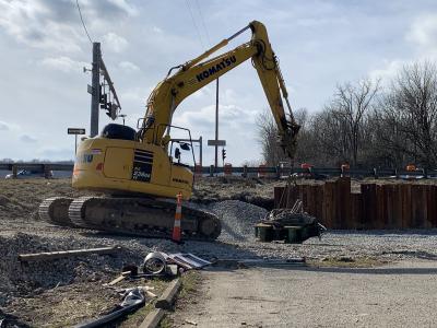
Tri-State then used cranes to set the structures, as well as an 800 series Link-Belt excavator.
Dobbins said that Tri-State’s innovation move to pre-cast the wet vaults saved “a ton of money.”
It also is the main reason that the project is currently a year ahead of schedule. Construction is now expected to be completed in fall 2008, instead of fall 2009 as originally planned.
An Educational Opportunity
At the east end of the project, where SR 202 meets Sahalee Way, WSDOT has built a 16-acre (6.4 ha) wetland mitigation site called Happy Valley.
Creation of the wetland area is considered a separate phase of the SR 202 project, with a budget of about $7 million. The wetland was constructed in order to meet WSDOT’s “no-net-loss” policy regarding wetland acreage and function.
Because the addition of two new lanes along nearly 3 mi. of SR 202 meant that the road encroached into the floodplain, WSDOT needed to create a spot for that same volume of water to fill.
Crews removed 12,000 dump truck loads of soil to create the new wetland. The deepened area has since been hand-planted with approximately 37,000 plants.
In the heart of the wetland is a backwater channel designed to be a haven for salmon and trout. Shady spots were constructed in the stream by securing tree stumps with steel cables, providing protected areas where the stream’s residents can hide from predators.
“In that area we have wildlife habitat coming back… bald eagles are coming back,” said Dobbins.
Wetland mitigation is an integral part of WSDOT’s standard environmental procedures.
However, because of its high-visibility location, the Happy Valley wetland has unique educational possibilities. After all, as people drive to Redmond from their homes on the Sammamish Plateau, they can’t help but pass by this spot.
Dobbins’ vision is that the wetland will eventually act as an outdoor classroom. An interpretive walking trail is in the works, and wildlife biologists are creating curriculums for the Lake Washington School District that incorporate wetland studies into grade school classes.
“It’s the one stop along Evans Creek where kids will be able to see salmon… everywhere else [the creek] is overgrown with blackberries,” explained Dobbins.
Dobbins hopes that if kids and parents alike can “understand the synergy of how this corner of the project protects the environment,” it will counter the common perception that civil engineers “just pave over wetlands.”
Once kids understand that civil engineers can and do protect the environment, Dobbins believes that more students will be inspired to consider civil engineering as a career path.
Although this type of public education is part of WSDOT’s long term vision, Dobbins commented “we just don’t have too many places we can do it.”
Flyover Ramp Ties In
WSDOT realized that widening SR 202 into Redmond would do little good if commuters still had to deal with the bottleneck that currently occurs where SR 202 intersects SR 520.
Many commuters who travel from the Sammamish Plateau along SR 202 continue onto SR 520 once they reach downtown Redmond.
In fact, nearly 40,000 drivers travel westbound on SR 520 from SR 202, every weekday. Many of these commuters are headed to Microsoft’s corporate campus in Redmond, just off of SR 520, which is currently being expanded to accommodate nearly 12,000 employees.
Drivers trying to enter SR 520 from SR 202 must now wait through two lights before turning left to reach the on-ramp.
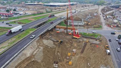
The new flyover ramp, which is being built by Tri-State Construction, will split to the right from westbound SR 202, cross under SR 520, then rise and run parallel to westbound SR 520 until it joins the highway from the right.
Construction for the flyover ramp began May 2, and is expected to be complete in late winter/early spring 2008. Earthwork is currently under way as crews build abutments; the bridge will go over 150-ft.-long (46 m) girders.
Originally, the $10 million ramp was scheduled to begin construction in 2009. But because Tri-State is so far ahead of schedule on Phase 2, WSDOT accelerated funding for the ramp.
“It all ties together,” said Dobbins. “It’s all about transitions, how it’s all supposed to work seamlessly.”
Although Dobbins referred to the SR 202/SR 520 flyover ramp as Phase 3 of the SR 202 to Sahalee Way project, the ramp can alternately be considered the first stage of the SR 520 widening project.
After the flyover ramp is finished, crews will add HOV and merge lanes to SR 520 between West Lake Sammamish Parkway and SR 202. Together, these measures should reduce peak morning commute time for Redmond-area drivers by 60 percent, and peak evening commute time by 75 percent. CEG
Today's top stories


