At Confusion Hill, located in far northern California, state of California engineers fought a soupy, slippery mountain for a decade trying to build Highway 101 through 200-ft. tall redwood trees.
The mountain won.
Highway 101 had closures each winter for the past 10 years. However, a decision was made to move the highway to the other side of Eel River’s South Fork and allow the soupy mountain have its way.
Confusion Hill was named for the “mysterious” roadside attraction where water seems to run uphill. Even buildings were tilted as if defying gravity. Caltrans attributed the area’s features to a large landslide that geologists said happened thousands of years ago.
According to geologists, that ancient rock slide has become more and more unstable in recent years, making Confusion Hill one of the most expensive spots in the state to fix roadwork.
The ancient landslide moved a 1,000-ft. (304.8 m) tall mass of rock and mud. The slide was 3,000 ft. (914 m) wide at the roadway level and more than 1,100 ft. (335 m) high measured from its toe at the river, according to Caltrans.
The roadway has experienced slipouts, retaining wall failures and debris flows over the past 17 years. Geotechnical studies indicated the slide is progressively losing strength but debris will continue to flow onto the highway. Engineering studies predicted long roadway closures and more extensive highway repairs in the near future.
The project rivals more famous geologic highway challenges like Devils Slide north of Half Moon Bay on Highway 1. Highway 101 and Interstate 5 are California’s two north-south arteries.
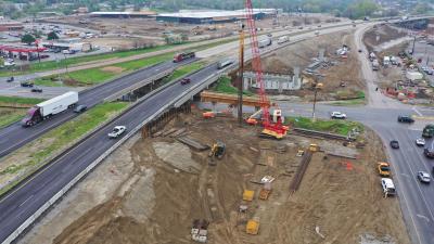
The $71 million Confusion Hill project will require construction of temporary access structures, two new bridges, excavation and removal of more than 10 million cu. ft. (280,000 cu m) of the mountain, and the eventual relocation of the highway to the other side of the South Fork on the Eel River.
The cost of fixing a forecast catastrophic landslide would be $45 million. That could still happen prior to the forecast completion of current work in 2009. The 2005 winter was the worst ever and the artery was closed for a week once. More than $6 million was spent fighting the slide, according to Caltrans figures.
Caltrans deemed only 1.9 mi. (3 km) of the highway to be part of the untamable geology. That stretch had vexed state constructors and engineers to the point of surrendering an existing, flat roadway in favor of building two big bridges.
The project used innovations such as having a traveler for construction of the south bridge 255 ft. (77.7 m) above the river. By contrast, the roadway of the Golden Gate Bridge is 220 ft. (67 m) above water, which used towers that were more than three times that high.
Caltrans’ resident engineer Ron Den Heyer explained that the cast in place segmental construction would feature 30-ft. (9.1 m) sections each in the shape of a giant ’T,’ with a 1,395-ft. (425 m) bridge, a result of the high steel work. The subcontractor on steel work is Fontana Steel. While the technology of the traveler is not new to conquering heights and rough terrain, its adaptation to such a remote location is bold.
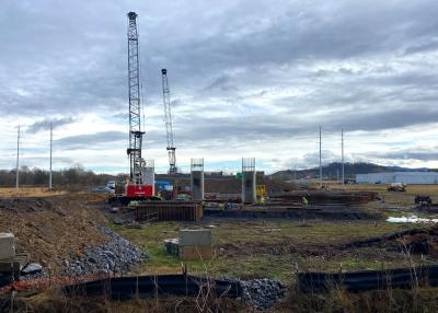
Getting equipment into the remote job site involved wiggling big equipment, such as three cranes and a pipe transport truck, through newly-created access roads.
James Ham, superintendent of the general contractor MCM, said that the environmental challenges made this job much less tolerable than others on which he worked. He was superintendent on a bigger nearby project in Mendocino County over the Noyo River and has been running bridge jobs for many years. MCM has built more than 1,000 bridges in California during its history.
“We are not talking two times worse, or three times worse, we are talking 100 times worse, to the point I am almost ready to walk away,” Ham said.
He explained that new environmental monitors who work for Caltrans and a plethora of regulatory agencies had dragged the job out needlessly with often contradictory requirements.
For example, after considering how many giant redwoods need to be cut, Caltrans selected a final option of four trees. MCM bid on that final option but then had to wait while new appeals of the approved plans were filed. These appeals were filed with the same agencies that had already signed off on them. Ham said the project is now 3 percent complete and work will continue all through the rainy winter months because of the urgency factor.
Ham said things have changed to make work much more difficult, with “zero tolerance” now the rule, both at Confusion Hill and another job further north in Fortuna of which he manages. Although shutdowns have been threatened, Ham indicated that there have been no stoppages at Confusion Hill.
MCM built a high trestle, a temporary steel bridge, on the north side to provide year-round access to the west side of the river, with minimal impact on the Eel, Ham said. To date, the biggest piece of equipment to be used on site was a 175-ton (158.7 t) Manitowoc model 4000 crane, which worked on the trestle. Booms up to 180 ft. (54.8 m) tall had been used on the cranes. The project employed two other cranes, a 3900 Manitowoc and a Link-Belt LS-338 FMC crane.
Despite its size, the trestle had to sit gently on the bottom of the Eel.
Den Heyer said 6-ft. (1.8 m) diameter corrugated pipes were used as a cofferdam. The round, smooth alluvial gravel made gripping very hard for the temporary structure.
“The stream bed is never flat,” Den Heyer said. “It was very difficult to get it so it doesn’t slip under the pipe. We had to get it down solid and that was a challenge.”
Access between the two bridges made transporting big equipment difficult.
“There is the big crane and some large loaders, excavators and off-road dump trucks, “ Den Heyer said.
The project used a JLG 120hx lift for road construction, for lifting transport workers and for moving equipment from the high trestle to the banks of the river.
Subcontractor Ladd Construction sunk tunnels up to 69 ft. (21 m) deep into the rock for the north bridge pier to create 30 degree reinforced concrete columns. The north bridge will be a mere 140 ft. (42.7 m) high and 531 ft.(161.8 m) long. Ladd had done recent work on the Hoover Dam bypass and wine tunnels in the Napa Valley.
Ham described how one tunnel was sunk in a cae alongside the river, while the giant crane worked above on the bluff, the workers below not even visible because of the terrain.
Ladd used Caterpillar for most of the costruction. However, Ham said Ladd had been using a specially adapted piece of equipment that sent a clamshell down a rail to scoop out the dirt, with one man in the shaft operating the device.
“It looked homemade and was interesting to watch,” Ham said. The tunnels were sunk with drilling by an Italian-made IMT-Industria Meccanica Trivelle AF 18 from Pacific Coast Drilling of Petaluma, followed by blasting, then removal of rock with the clamshell.
Recntly, Ladd used a half dozen huge off road dump trucks on the job site along with massive Cat 320-25 and 350 Series excavators.
Ladd Construction was not available for comment .
Mercer Frasier Asphalt of Eureka was the subcontractor doing concrete and earthwork for the project.
A Webcam aimed at Confusion Hill showed that the mushy mountain was moving onto Highway 101 once again. The entire mountain is covered with steel netting. In addition, concrete freeway dividers run along the road, quickly catching the slipping, soupy hillside. But the fight is a losing one.
“A catastrophic slide at Confusion Hill could close U.S. 101 in both directions for six months or more,” Caltrans documents wrote. “A one-direction closure could cost the traveling public an estimated $1.7 million per month in travel delay and vehicle operating costs. A complete closure could require a 250-mi. one-way detour on mountain roads and could cost an estimated $7.1 million per month in travel delay and added vehicle operating costs.”
The slide-prone area is located between two bizarre tourist attractions, Confusion Hill and The World Famous Tree House, an entire multi-story gift shop inside a single, living redwood tree.
That segment of Highway 101 between Leggett and Piercy has one of the highest rainfall rates in California. According to the Oregon Climate Center, the study area received between 70 and 100 in. (177.8 to 254 cm) of rainfall per year between 1961 and 1991. This rainfall adds to the level of saturation of the landslide masses, decreasing their stability.
In the near future, Talitha Stimson of Caltrans said there will be links on northcoastweather.com to view the progress of construction of the south bridge.
“It is definitely a challenging project, with mining and tunneling for the north bridge pier shafts, extensive falsework for the north bridge superstructure, the innovative segmental construction for the south bridge, and controlled blasting for the roadway through-cuts,” Stimson said. CEG
Today's top stories


