Virginia’s longest roadway, the 508-mi. (813 km) Route 58, stretches from the Atlantic Ocean to the southwestern tip of Virginia. In 1989 the Virginia General Assembly established the Route 58 Corridor Development Plan to enhance economic development along the route, especially in the rural sections. Roanoke, Va.-based Branch Highways Inc. entered a public-private partnership agreement with the Virginia Department of Transportation (VDOT) where the company will design, build and widen 36 mi. (58 km) of the corridor between Hillsville and Stuart as funding becomes available.
Under this Public-Private Transportation Act (PPTA) comprehensive agreement, the first segment completed by Branch was the widening of Route 58 in Meadows of Dan during 2006. The second segment, currently under construction, is the Hillsville Bypass in Carroll County. Mike Higgins, senior project manager of Branch, believes that projects completed under PPTA agreements are generally “faster than traditional methods.”
Branch’s PPTA agreement allows for six additional construction phases that will occur between Stuart and Hillsville. Robbie Williams, area construction engineer of VDOT’s Salem district, stated, “Subsequent phases will be built as funding becomes available.”
Branch Highways is currently working on the second segment, which is an $83-million contract that includes construction of a new 5.2-mi. (8 km) section of Route 58 around the town of Hillsville. This Hillsville Bypass will improve the connection between Route 58 and Interstate 77. The roadway will be four lanes built at a new location, with two 12-ft. (3.7 m) travel lanes in each direction, paved shoulders, and a grassy median. The contract also consists of the construction of three new interchanges and eight new bridges. Construction began in fall 2007 and is scheduled to be completed in November 2011.
Two of the three new interchanges will be located at each end of the new bypass: one to connect to Route 58 Business and one at Route 52. The Route 52 interchange, located just south of Hillsville, will provide a more direct connection for commercial vehicles traveling from Route 52 to I-77. This will minimize Hillsville’s current congestion problem. Higgins confirmed, “The Hillsville Bypass will link truck traffic without going through town.”
Also part of the contract are the eight new bridges, which will be cast in place concrete bridges with concrete decks and steel support members. Two of the bridges will carry traffic over Little Reed Island Creek. The remaining six bridges will, according to Higgins, “either carry Route 58 over secondary roads or carry secondary roads over Route 58.”
This includes one bridge carrying Route 780/Howlett Street over the new bypass and a pair that will carry Route 58 over Route 670/Snake Creek Road.
At this time, one bridge has been completed and three are under construction. This includes the eastbound Route 58 bridge over Little Reed Island Creek, which is closed for reconstruction. The bridge is situated between the western limits of Hillsville and I-77 near Gardner Mill Road. While the bridge is being widened and the riding surface replaced, Route 58 traffic in this area will be reduced to one lane in each direction. The bridgework is being done by a local subcontractor who has about a half dozen track crawler cranes onsite including hydraulic cranes and boom cranes.
Branch self performs grading, drainage, erosion control, and traffic control portions of the contract. Higgins stated that Branch handles the “primary, heavy highway aspects of the project.” The asphalt paving work is subbed out though.
So far, Branch has completed approximately 50 percent of the mass excavation work and 95 percent of the deep storm drainage work. Starting this year, workers will perform surface drainage work, base stone work and asphalt pavement operations.
“We will be working from the west heading east,” said Higgins. Approximately 100,000 tons (90,000 t) of stone will be put down and 85,000 tons (76,500 t) of asphalt will be placed on the roadway. Additionally, workers will lay about 30,000 linear ft. (9,144 m) of drainage pipe.
The Hillsville Bypass project involves Branch moving roughly 4.5 million cu. yd. (3.4 million cu m) of rock and dirt. Higgins described the equipment being used for the excavation and earthwork as a “fleet of 777 Cats, models Cs & Ds, rigid frame end dumps.”
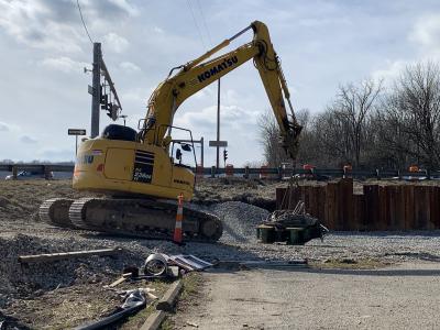
Excavators on hand for loading the trucks are a Komatsu PC1100 and a Komatsu PC 600 LC, to name a couple. Also readily available are D9 and D8 Cat bulldozers for support.
Branch is utilizing GPS equipment for the mass excavation, minor earthwork, and grading for the road.
“This is one of the first projects in Virginia to use fully-automated GPS capabilities on a project of this magnitude,” Higgins explained. All of the company’s motorgraders are equipped with full GPS capability in addition to bulldozers and much more.
A challenging aspect of this project is the amount of earthwork and bridgework that has to be done within an environmentally sensitive area. The contractor has to ensure that all erosion control measures are in place for the duration of the project. Branch is performing “sizeable wetlands and stream mitigation,” Higgins commented, “as well as creating wetlands that will replace wetlands.”
For the entire Route 58 Corridor, most other sections from Norfolk to Stuart have been upgraded to four lanes. However, there are more than 28 mi. (45 km) of roadway left to be improved in the six remaining phases on Branch’s agreement. Road improvements, if funded, could occur in the areas of Lover’s Leap Mountain, Vesta, Tri-County, Laurel Fork, Crooked Oak and Route 669. CEG
Today's top stories


