


Our Main Office
Construction Equipment Guide
470 Maryland Drive
Fort Washington, PA 19034
800-523-2200
Wed December 03, 2008 - Midwest Edition
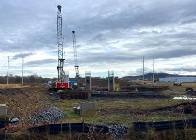
The Iowa Department of Transportation (DOT) is implementing one of the world’s largest DOT-owned statewide networks of GNSS continuously operating reference stations (CORS).
Called the Iowa Real Time Network (IaRTN), this statewide Real Time Kinematic-Global Positioning System (RTK-GPS) network will provide authorized public and private users near-instantaneous GPS satellite corrections for accurate and precise positioning anywhere in the state.
“The IaRTN will significantly improve the efficiency and accuracy of determining survey-level GNSS coordinates, and, in most cases, eliminate the need to install base stations or proprietary networks,” Mike Jackson, special projects engineer with Iowa DOT, said. “It’s a network built with unlimited potential that can be used by a vast array of users from surveyors and contractors to farmers.”
Provided by Leica Geosystems, the IaRTN network includes a total of 80 stations. Each station will include a Leica GRX1200 GG Pro GNSS receiver with ethernet capabilities. CORS stations are spaced about 43.5 mi. (70 km) apart and the network is designed to provide coverage anywhere in the state of Iowa. The satellite referencing network will utilize more than 40 currently operational satellites, as well as another 40 or more that will become operational with system upgrades and additions to the GPS and GLONASS systems as well as Galileo satellites. RTK data will be available to the agency and public 24/7 via the Internet.
The backbone of the network will be Leica Geosystems’ SpiderNet network software, an integrated suite of networking software that adjusts for the ionic and tropospheric conditions, and solves for ambiguities throughout the network before sending a network-corrected signal to the rover or end user. Rather than merely getting information from the closest reference station, the user is getting corrections based on the entire network. Leica SpiderWeb will be used to distribute the GNSS data via the Internet for access using a standard Web browser.
“Reference station networks like Iowa’s provide a fundamental tool for engineering and survey professionals throughout the state,” Wendy Watson, Leica Geosystems project manager for the Iowa DOT project, added. “Beyond surveying, the network can be used to monitor the movement of bridges and dams, support machine control activities on road construction projects, play a role in accident reporting of local police departments, and so much more. It’s an investment in the future.”
The IaRTN is scheduled to launch to the public in February 2009, just one year after receiving a Notice to Proceed, making it one of the fastest referencing station networks ever constructed. Leica Geosystems has a renewable two year contract to manage the administration and monitoring of the Iowa DOT network as well.
For more information on Leica Geosystems’ reference station network solutions, visit www.leica-geosystems.com/us/en/lgs_4229.htm.
For more information on the IaRTN, visit www.iowadot.gov/rtn/.
Construction Equipment Guide
470 Maryland Drive
Fort Washington, PA 19034
800-523-2200
Construction Equipment Guide covers the nation with its four regional newspapers, offering construction and industry news and information along with new and used construction equipment for sale from dealers in your area. Now we extend those services and information to the internet. Making it as easy as possible to find the news and equipment that you need and want.
Contents Copyrighted 2024, by Construction Equipment Guide, which is a Registered Trademark, registered in the U.S. Patent Office. Registration number 0957323. All rights reserved, nothing may be reprinted or reproduced (including framing) in whole or part without written permission from the publisher. All editorial material, photographs, drawings, letters, and other material will be treated as unconditionally assigned for publication and copyright purposes and are subject to Construction Equipment Guide’s unrestricted right to edit and comment editorially. Contributor articles do not necessarily reflect the policy or opinions of this publication.
Read our privacy policy here.
Mastodon