
U.S. 58 in southwestern Virginia carries traffic through picturesque scenery, like Jefferson National Forest and topping Lover's Leap Mountain.
Although the scenery can be impressive, the curving two-lane roads with steep downhills can test motorists' patience and nerves and is problematic for truckers.
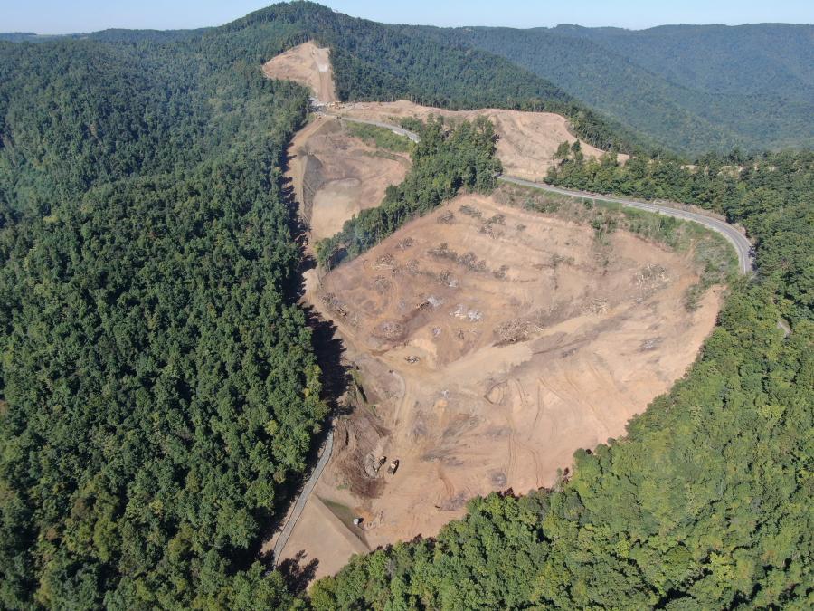
Virginia Department of Transportation (VDOT) has partnered with Branch Civil to fix some of these difficulties on a 7.4-mi. stretch that includes the road over Lover's Leap Mountain. The state intends to widen the road from two lanes to four, enhance access to the Lover's Leap overlook and remove some of the anxiety from the steep downgrades.
The $300 million design-build project began in 2021 and will be completed in 2026.
In addition to widening Route 58, plans for the project include building wider shoulders, improving secondary road connections, enhancing the intersection with Route 8, adding turn lanes at secondary road connections, and providing two truck escape ramps and a truck brake check area. The Lover's Leap Overlook, now just a pull-off, will have increased parking and turn lanes for safely entering and exiting the overlook from U.S. 58.
The project will have three components.
Western segment: Four lanes with raised, grass median (18 ft.), also will provide the width for left-hand turn lanes to make secondary road connections.
Central segment: Four lanes with wide separation between eastbound and westbound lanes. Two new eastbound lanes will be constructed. The new construction will provide gentler downhill grades.
Eastern segment: Two lanes in each direction with a 4-ft. paved median that connects to the existing Stuart Bypass.
The job is part of a larger 36-mi. corridor improvement program beginning southwest of Hillsville and continuing east through Carroll, Floyd and Patrick counties to approximately 1 mile west of Stuart. The Route 58 Corridor from Hillsville to Stuart is the last remaining section to complete the widening of Route 58 from Virginia Beach to I-77. The Lover's Leap section is the fourth and most critical section out of the six sections to be constructed between Hillsville and Stuart with Branch Civil being the Design-Builder for these first four sections.
The current project begins just east of Vesta and ends at the existing four-lane Route 58 Stuart Bypass.
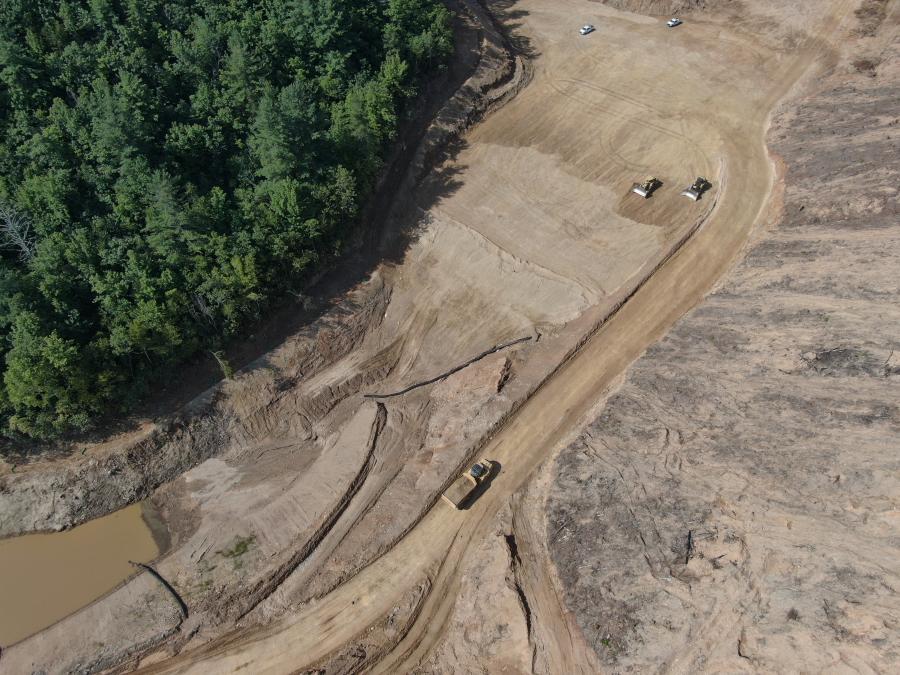
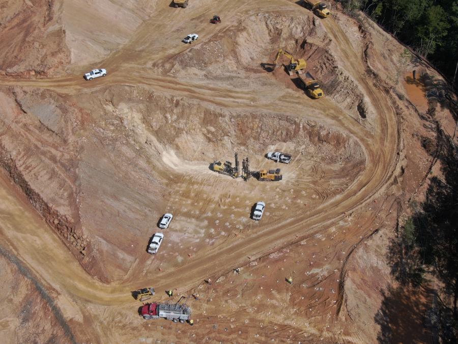
Transforming a steep and winding two-lane mountain road into a flatter and straighter four-lane highway, complete with shoulders and guardrails, means that workers and their equipment will have to take some huge bites out of existing hills and mountains and fill existing deep hollows.
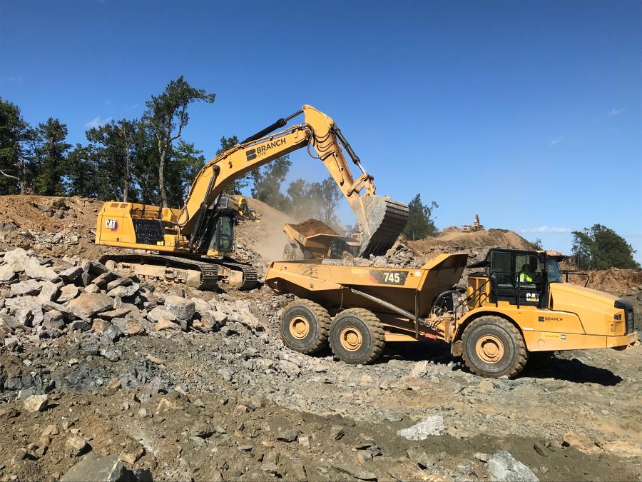
Cut sections can be as much as 500 ft. in height and fills as much as 300 ft. deep. The total excavation will be enormous — approximately 11 million cu. yds.
"I've been doing construction all my life and it's the largest earthmoving project I've ever been associated with," said Jeff Humphreys, design-build project manager of Branch Civil.
A project of this size has large needs for permanent materials.
- 429,000 tons of crushed aggregate
- 168,000 tons of asphalt
- 7,800 ft. of large-diameter pipe for deep drainage
- 37,000 ft. of small-diameter pipe for surface drainage
- 92,000 ft. of guardrail.
- Nine precast box culverts
Humphreys believes truckers will love this project when completed.
"We are taking a lot of curves out of the road," he said. "Also, the existing road has 9 percent grades, while the new roadway will have a maximum 7.4 percent downgrade. The new roadway lanes also will be 12-feet wide, with shoulders. The old lanes are a foot narrower with very narrow or no shoulders."
Some 60 percent of the project contains solid rock, with the rest being a mix of clay and sandy soil. Blasting of the rock is going as expected. Humphreys noted, "Most of the material we remove will be used as fill for the new roadway."
Workers have been vigilant with the blasting and drilling so as not to disrupt normal traffic. They also have been careful with the 400 acres of land they impact.
"Our people are trying to disturb no more than what is needed," said Humphreys. "Trees that are being removed are being salvaged as timber, turned into firewood or mulch. We have also modified the design of the project so that we dislodge less land than we had originally estimated."
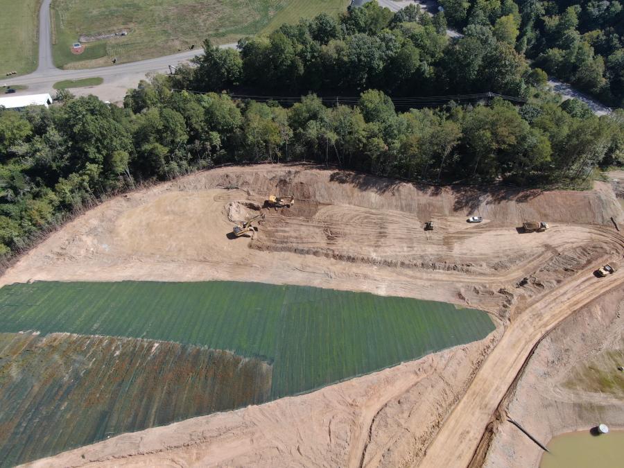
Reducing the impact on the land means less effect on streams as well. Still, the project has made careful plans for streams and stormwater.
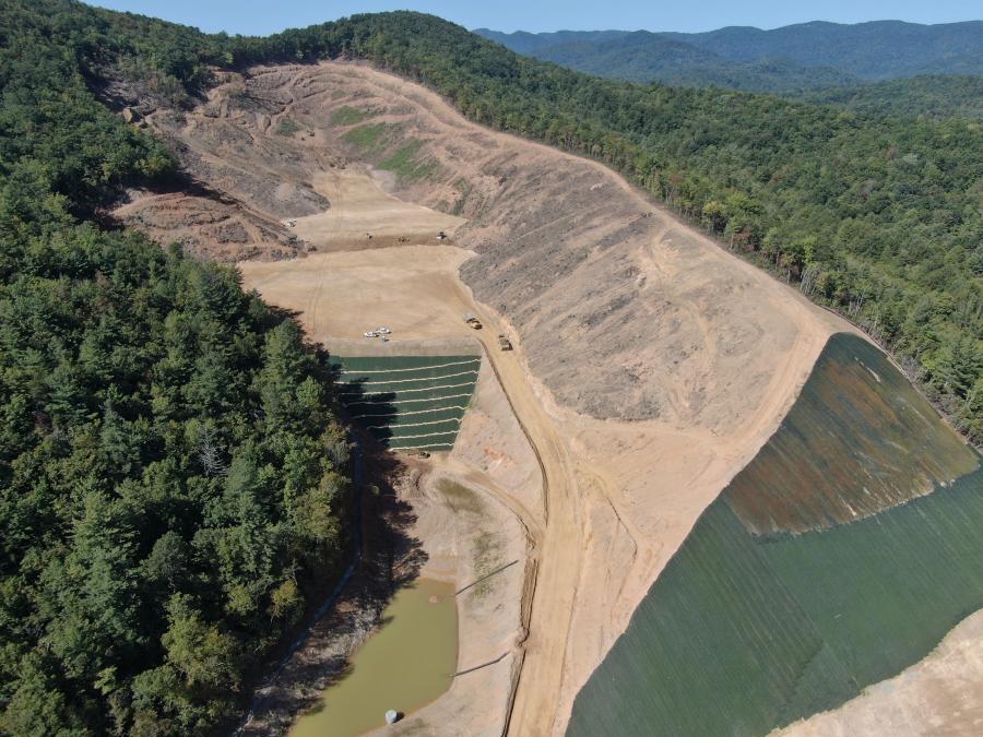
"Before constructing the road, we will be placing large diameter culverts for handling the existing streams," said Humphreys. "Twenty-nine new stormwater management basins will handle normal rains and runoff. They help remove silt and earth from storm waters so it can return to the groundwater cleaner than it might if unfiltered."
Unlike paving, the excavation can be done nearly year around. But weather does present issues in this mountainous terrain.
"We try to work on top of the mountain and at times are shut out because it's foggy and icy," said Humphreys. "Then we move our team to the other end of the job and it's clear and sunny."
Safety is a priority for the team. Full-time safety personal and traffic maintenance people are assigned to the site and a project safety committee monitors the work regularly.
The attention to safety is essential with the prevalence of large pieces of equipment rumbling around the project and active blasting operations. The finished project is hard to envision as project completion is still a long way off. Humphreys is confident though that the finished product will be satisfying for motorists and truckers.
At present, Branch is using a Cat 385 excavator, two Cat 374 excavators, Cat D8 and D10 dozers and Cat 45-ton articulated dump trucks for the earthwork, supported by a fleet of smaller pieces. Efforts are also under way to mobilize 100-ton rigid frame trucks and an appropriately sized excavator for upcoming earthwork.
Shannon Valentine of the VDOT at project inception, agreed about the significance of the project.
"Every year thousands of commuters, travelers and truckers take Route 58 as they travel along our Commonwealth's southern border. The project represents a continuation of a multi-decade investment in the people and communities of rural and southwest Virginia." CEG


