


Our Main Office
Construction Equipment Guide
470 Maryland Drive
Fort Washington, PA 19034
800-523-2200
Wed June 07, 2006 - Southeast Edition
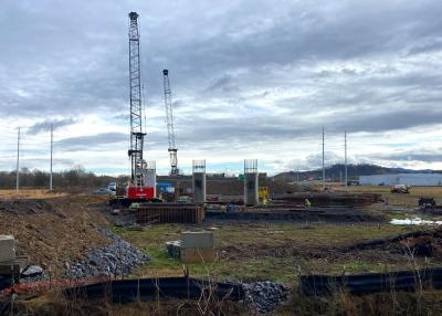
The South Carolina Department of Transportation (SCDOT) and The Federal Highway Administration (FHWA) have recommended a preferred alternative for the Southern Project of I-73 in South Carolina from I-95 in the Dillon/Latta area to Highway 22 in the Conway/Myrtle Beach area.
I-73 was divided into two sections in South Carolina, one north of I-95 and another south of I-95. The announcement of potential alternative corridors for the Northern Project, and the scheduling of public information meetings in that area, will be made later this summer.
“The selection of the recommended preferred alternative is the result of over two years of efforts by the project team and represents unprecedented cooperation with 13 other resource and regulatory agencies on this project,” said Mitchell Metts, the SCDOT I-73 project manager.
Patrick Tyndall, FHWA environmental coordinator added, “We have made many changes to the corridors that were first presented in the spring of 2005 based on the significant amount of input from these agencies as well as the stakeholders working group and the general public.”
During this project, two “public scoping” meetings were conducted in September 2004 and four public information meetings were held in March and May of 2005. The project team also benefited from meetings with a significant number of church congregations, service organizations and social fraternities and sororities. The project team spent a considerable amount of time researching the natural and human environment of the study area to understand the potential impacts associated with each of the proposed alternatives.
“Over the past two years, we have heard from many persons regarding their thoughts about the alignment,” Metts said.
The results of these comments have produced a preferred alternative. This route was selected over all of the other routes that were considered because this preferred alternative would have the least wetland impacts in both acreage (384 acres) and wetland value, the least impact to farmland (1,708 acres), the least impact to potential historic resources and had the lowest relative cost. This alternative would be the least likely to lead to changes in the land use, thus changes to the way of life. This is in keeping with the opinion expressed by the public at meetings, in letters, telephone calls and by the elected officials.
“The project team has done a tremendous amount of work in taking public comment and evaluating all the factors involved in selecting the preferred route,” said SCDOT Executive Director Elizabeth S. Mabry.
Bob Lee, FHWA division administrator noted, “And at the same time, working closely with 15 different state and federal agencies to incorporate their concerns into this preferred alternative. With continued support and cooperation, we’re on schedule to complete the environmental process in less than three years, as promised.”
Mabry added, “Other state DOTs typically take six or more years. However, due to the importance and significance of this vital interstate project, we felt that it was necessary to complete the impact study at an accelerated rate, but still providing every opportunity for the people in this region to be heard.”
Proposed Route
This alignment would begin at the southernmost interchange with I-95, and from there would extend southeast on the western side of Latta where it would have an interchange with U.S. Route 501, would cross to the east immediately north of Temperance Hill, then extend southeast where it would interchange with SC Route 41A. It would continue southeast and would have an interchange with U.S. Route 76 on the western side of Mullins. Once south of Mullins it would angle slightly east and cross the Little Pee Dee River at the existing SC Route 917 crossing. It would have an interchange with S-308, then continue southeast on new alignment to an interchange with SC Route 22 near Bakers Chapel, approximately 2 mi. west of the SC Route 701/SC Route 22 interchange. The interchange with SC Route 22 would be designed so that the traffic movement from I-73 to SC Route 22 would be the predominant movement through the interchange. It then would follow SC Route 22 to its terminus with U.S. Route 17 near Briarcliff Acres.
Public hearings to view maps showing this recommended preferred alternative have been scheduled for locations throughout the state. Comments taken at the public hearings could contribute to minor alterations in the final route.
“Because we are still very much engaged in the public involvement process of this project, it is very important that the public attend these meetings and let us know what they think about the route,” Metts said.
For more information, visit www.I73inSC.com.
Construction Equipment Guide
470 Maryland Drive
Fort Washington, PA 19034
800-523-2200
Construction Equipment Guide covers the nation with its four regional newspapers, offering construction and industry news and information along with new and used construction equipment for sale from dealers in your area. Now we extend those services and information to the internet. Making it as easy as possible to find the news and equipment that you need and want.
Contents Copyrighted 2024, by Construction Equipment Guide, which is a Registered Trademark, registered in the U.S. Patent Office. Registration number 0957323. All rights reserved, nothing may be reprinted or reproduced (including framing) in whole or part without written permission from the publisher. All editorial material, photographs, drawings, letters, and other material will be treated as unconditionally assigned for publication and copyright purposes and are subject to Construction Equipment Guide’s unrestricted right to edit and comment editorially. Contributor articles do not necessarily reflect the policy or opinions of this publication.
Read our privacy policy here.
Mastodon