

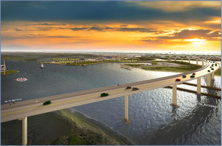
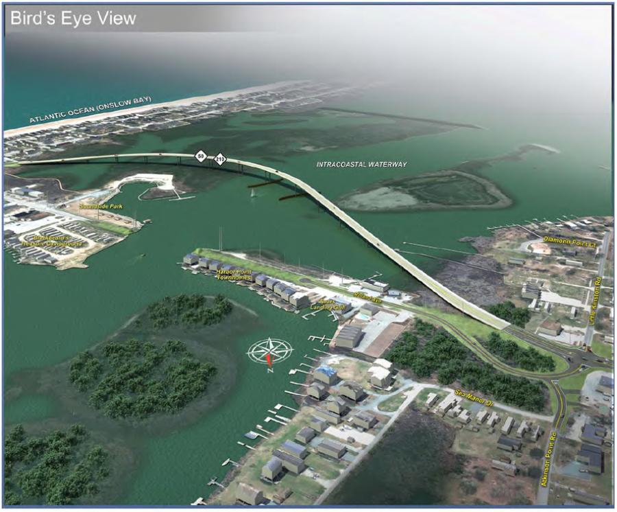
The N.C. Department of Transportation is building a bridge to replace the existing swing bridge over the Intracoastal Waterway on N.C. 50/210 in Surf City.
The existing bridge – one of two bridges providing access to Topsail Island – is a steel truss swing span bridge that more than 60 years old and due for replacement.
The new bridge will have a 65-foot vertical clearance that will not need to open for vessels in the waterway, eliminating vehicle and vessel traffic delays from the bridge opening and closing.
The new bridge will also:
Provide a connecting structure between the mainland and the island that has sufficient capacity allowing for emergency access, hurricane evacuation and acceptable travel times
Improve the structural capacity of the bridge
Provide consistency with state and local land use and transportation plans
Project Highlights
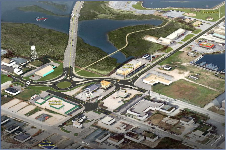
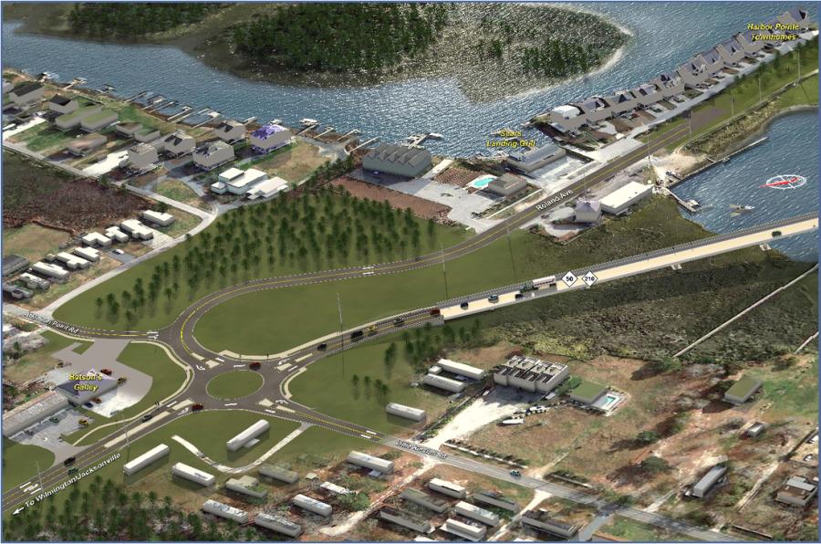
Work involves building a high-level, fixed-span bridge (2.0MB) – that will be approximately 1,100 feet south of the existing bridge – beginning on the mainland side, just west of Atkinson Point Road, and ending on the island side at Topsail Drive (N.C. 50).
The project also includes an island tie-in – a three-legged roundabout on Topsail Island (2.7MB) – that will be located approximately 300 feet south of Roland Avenue.
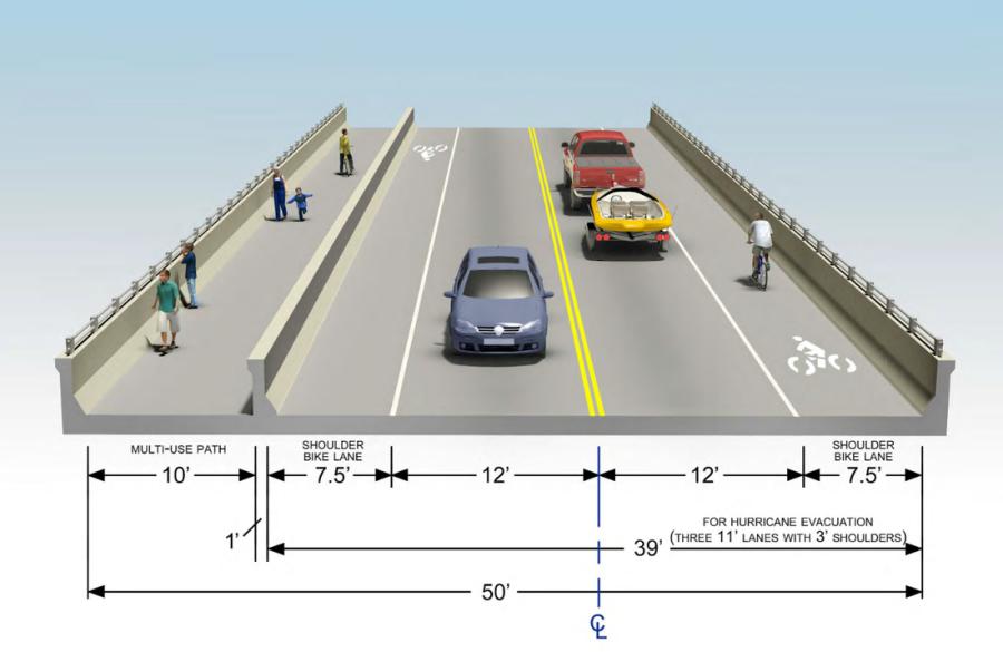
The recommended bridge typical section includes:
A 10-foot multi-use path on the north side of the bridge, separated from the travel lanes by a concrete barrier
A 7.5-foot bicycle lane/shoulder in each direction
A 12-foot travel lane in each direction
A 39-foot roadway width carrying the bicycle and travel lanes, which allows for an alternate evacuation configuration for emergencies or hurricanes – two lanes off of the island, one lane onto the island
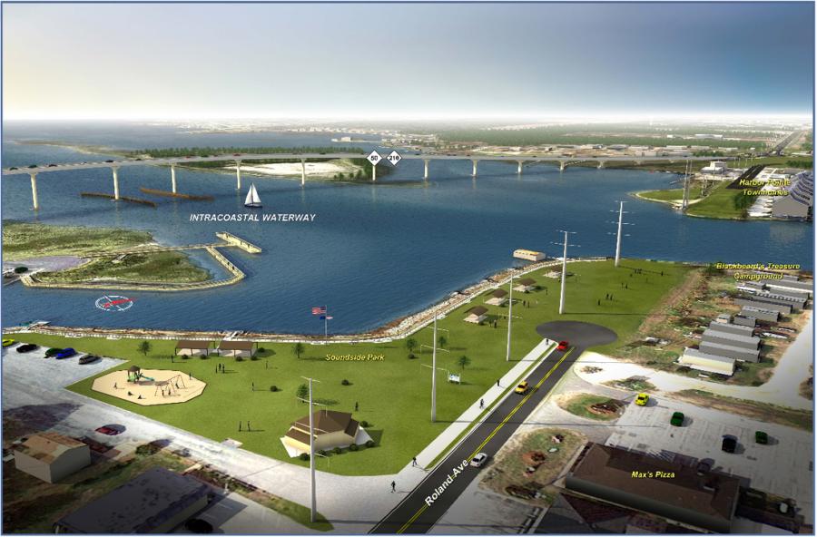
Alternative 17 skirts the southern boundary of Soundside Park (2.1MB) and will not have a negative impact on the park.
Other reasons that NCDOT identified the option as the Preferred Alternative is because it:
Results in the least number of residential and business relocations
Replaces the existing swing bridge with a 65-foot high-level fixed bridge, eliminating vehicular/vessel delays from bridge openings/closings
Has no impacts to ponds or streams and minimal wetland impacts
Was the most preferred from citizen comments
Maintains a connection to the existing central business district
Has the lowest total cost ($53.7 million), while the other alternatives are approximately 10 percent to 75 percent higher in cost
Can be built without requiring a detour bridge and without closing the existing bridge during construction
For more information, visit NCDOT at http://url.ie/11nrl.