After years of delay and controversy, the Tennessee Department of Transportation (TDOT) finally began work on a new Reelfoot Spillway, a new spillway channel and a new bridge over the channel at Reelfoot Lake in July 2009. The original spillway, constructed in 1931, was deemed “structurally deficient,” with inspections indicating that it exhibits “advanced section loss, deterioration, spalling and scour,” according to TDOT. The newly configured spillway and bridge will be separate entities, with the new spillway located 1,000 ft. (304 m) west of the existing structure.
Serving a dual purpose, the original spillway carries a two-lane bridge as part of State Route 21 and controls the water levels of Reelfoot Lake that flow into Running Reelfoot Bayou, restricting water from draining out during droughts and releasing a steady overflow during rainy periods.
However, the Depression-era structure has been plagued by cracks that have leaked water from the lake during summer months when rainfall is scarce. In fact, emergency repairs have been necessary to prevent collapse because a spillway failure could drain the 25-sq.-mi. (64 sq km) lake, located 100 mi. (160 km) north of Memphis at Tiptonville. Collapse of the 70-year-old spillway also would wipe out the highway bridge, impacting tourism and local commuters.
Bleak Beginnings
Formed by the New Madrid earthquakes in 1811-1812, Reelfoot Lake is located between Lake and Obion counties in northwestern Tennessee. This natural lake encompasses approximately 15,000 acres of shallow, open water and vegetated wetland habitat. It has been designated a Class I Scenic-Recreational Area and Wildlife Management Area administered by the Tennessee Wildlife Resources Agency, as well as an Outstanding National Resource Water by the Tennessee Water Quality Control Board.
Popular as a fishing and recreational destination, it figures prominently in the area’s economy.
To determine its importance, County Technical Assistance Service, an agency of the University of Tennessee Institute for Public Service, in collaboration with the UT Knoxville Center for Transportation Research, U.S. Rep. John Tanner and State Rep. Phillip Pinion, financed an economic impact study of the Reelfoot Lake area and studied the contributions recreation activities make to the regional economy.
Research indicated that loss of the spillway would result in decreased visitation, income, jobs and tax revenue associated with recreational activity. Property values in both Lake and Obion counties also would decline.
The study also indicated that the spillway was difficult to operate and leaking badly, and that a failure would turn Reelfoot Lake into a mud flat and destroy the bridge on State Route 21, the most convenient route from the east into Tiptonville. The existing spillway had outlived its design life, was deteriorating, and was no longer adequate to manage the water level of Reelfoot Lake.
Borrowed Time
Conclusions that the spillway was deteriorating weren’t new. According to the State Gazette, in 2001 specialists speculated that the spillway might last only another five years, considering it “almost inoperable” and leaving the impression that it was on borrowed time even then.
Predictions by the U.S. Army Corps of Engineers echoed that sentiment, indicating that it could fail at any time, but dire warnings weren’t enough to speed studies, agreement or funding for the work. Insistence by the USACE, U.S. Fish and Wildlife Service, Tennessee Conservation League and Tennessee Wildlife Resources Agency that a new spillway was needed urgently also failed to speed progress.
These groups stressed problems such as siltation and poor water quality in Reelfoot Lake, encroachment of aquatic plants, erosion and tourism dependent on wildlife, water quality and access. The USACE rated the bridge “functionally obsolete,” further threatening tourism.
But Kentucky landowners cited opposing issues in an effort to block federal funding of the project. The USACE acknowledged that 14 acres of land might be affected during the summer, leading Kentucky lawmakers to fight construction of the new spillway out of concern for flooding of low-lying fields north of the lake due to the water level being raised above its current summer average, despite numerous studies demonstrating that this wasn’t true.
In the early part of the last decade, the Corps estimated the cost of the project topping $30 million. State and local agencies in Tennessee needed the federal partnership to fund the work, with the Corps citing the need for congressional support.
Support came from fishermen and hunters, local resorts and other tourist outlets, county governments and the highway department, but not from Congress or from Kentucky. Some landowners also wanted to know if Running Reelfoot Bayou would be cleaned out to reduce the risk of flooding. Many residents wanted a four-lane bridge.
TDOT to the Rescue
TDOT took on the project in 2003, obtaining $13 million in federal funding in March 2008 to replace the bridge and relying on state funds for the spillway, but it hasn’t been a smooth sail.
In 1999 the Memphis District of the U.S. Army Corps of Engineers prepared the Reelfoot Lake Tennessee and Kentucky Final Feasibility Report and Final Environmental Impact Statement, September 1999 (EIS). Its four volumes consist of a detailed analysis of various plans for addressing problems in the Reelfoot Lake area, including replacement of the spillway. TDOT had hoped to use the documents, but instead, had to repeat much of the work.
The environmental permitting process also took longer than expected, according to Jim Zeigler, senior transportation engineer with Neel-Schaffer, a Nashville engineering firm working with TDOT.
The project required a permit because it will destroy an estimated 15 acres of wetlands. The permit sets conditions outlining how TDOT must compensate for the environmental damage.
“We currently have an ongoing mitigation contract to assist us with environmental damages,” said Nichole Lawrence, TDOT Region 4 employee relations/community relations officer.
The contract calls for the construction of a required mitigation site.
According to Lawrence, the “wetland at Reelfoot is the only Tier 3 wetland in the state. Tier 3 waters have unique characteristics to be preserved.”
Per the Natural Resources Protection Act, projects affecting wetlands of special significance or affecting greater than one acre of wetland must undergo a full review to analyze alternatives and compensation requirements to mitigate for lost wetland functions.
The four types of physical compensation allowed in the regulatory program include creation, enhancement, restoration and preservation.
Creation is considered expensive and risky. Enhancement increases the net value of a wetland and includes efforts such as the planting of vegetation beneficial to wildlife, improving buffers in and around remaining wetland or increasing the amount of standing water for amphibians or waterfowl. Restoration involves returning a disturbed or altered wetland to its previous or better condition through fill removal, replanting of vegetation, re-grading and reestablishing ground or surface water flows. Preservation consists of protection measures like conservation easements and deed covenants to maintain a wetland area in its natural or undeveloped condition.
Overcoming Roadblocks
The environmental permitting process was expected to be completed by November 2005, but an immediate roadblock surfaced. In answer to the question of whether any historical sites existed in the construction zone, the state historic-preservation officer replied “maybe.” And, because the spillway bridge is considered eligible for an historical designation, TDOT had to either find a way to leave the structure intact or the go through a yearlong process to justify its destruction.
Because it didn’t meet state bridge standards and was considered functionally obsolete and costly to maintain, TDOT preferred to build a retaining wall of sheet metal in a narrow channel leading from the Spillway Motel to the spillway itself. Then, the channel between the new retaining wall and the spillway would be filled with dirt.
TDOT submitted a permit application in February 2006 for the new spillway, spillway channel and bridge. A month later, an amended permit application was submitted to the USACE and the Tennessee Department of Environment and Conservation. Public hearings were held, including two regarding a required navigation permit for the project.
Construction was expected to begin following acquisition of about 75 acres of land for right-of-way from state agencies and a private owner in 2006, but that continued until 2009. And although TDOT applied for state and federal water quality permits that would allow the department to build separate bridge and spillway structures about 1,000 ft. (305 m) west of the current spillway bridge and a Reelfoot Lake navigation permit, which regulates any activity on the lake that could interfere with navigation, the Tennessee Department of Environment and Conservation asked TDOT to review all of the alternatives again. A consultant was hired to test submerged soils for contamination before digging a new channel from Reelfoot Lake to Running Reelfoot Bayou.
A series of circulation channels on the lake is intended to improve flow between what are now stagnant areas and is part of the USACE’s initial presentation. The model plan addressed the worst scenarios of floods and drought, along with consideration upstream and downstream for farmers tilling lowlands.
In 2004, the State Gazette reported concerns expressed by several farmers with adjacent land exposed to frequent flooding when the spillway is opened. The Tennessee Attorney General’s office responded to their questions that “the West Tennessee River Basin Authority is the entity responsible for maintaining and coordinating drainage work and flood control in Running Reelfoot Bayou. As a result of lawsuits in the 1970s and 1980s and water-quality regulations, the basin authority has not used a dragline or dredged a river in years. Accumulations of woody debris are removed in accordance with a 1985 federal court order and water-quality regulations.”
Greg Wathen, representing the organization, said the existing spillway is “almost inoperable and it is difficult to control lake levels and the amount of water leaving the spillway.” The new spillway is expected to give the U.S. Fish and Wildlife Service more control.
Since 1930 water levels in the lake have been somewhat regulated by the spillway at the southern end of the lake, where the Running Reelfoot Bayou flows out of it. The USFWS administers operation of the water levels at the current spillway at Reelfoot Lake, under the terms of a lease agreement with the State of Tennessee, and under an Interim Water Management Plan. The West Tennessee River Basin Authority is responsible for maintaining and coordinating drainage and flood control on the bayou.
The project, despite increasing the size of the spillway, will not alter the current water management plan for Reelfoot Lake, which is administered by the U.S. Fish and Wildlife Service. Operating under an interim plan that holds the winter pool at an elevation of 283.2 ft. (86.3 m) and a summer pool at 282.7 ft. (86.1 m), the USFWS had to meet mitigation measures before raising the lake to higher levels. Lawrence indicated that “the water levels are being maintained at a designated elevation by TWRA.”
Plans and Contracts
Lawrence explained that the project was divided into several components: the bridge with a budget of $4.3 million; the spillway with a budget of $9.3 million; and the channel with a cost of $6.3 million. In June 2009, TDOT accepted Dement Construction Company’s bid of $19.9 million for the construction of the Reelfoot Spillway and Bridge Project.
This project is 100 percent state-funded, she pointed out.
The $19 million bid sounds like less than early estimates of a $30 million price tag, but Lawrence explained that’s because right of way acquisition, the box bridge and environmental mitigation are all under separate contracts.
“The $19.9 is just a piece of the total package, and the $30 million being the total estimate for the entire job.”
The box culvert was built under a different contract and is now complete.
“This box was built as a relief structure to push the water, not allowing it to enter the existing Spillway,” said Lawrence.
The 3,000- to 3,500-ft. (914 to 107 m)-long canal will connect the new spillway to Running Reelfoot Bayou. Located near the intersection of routes 21 and 22, the box culvert serves the dual purpose of alleviating annual flooding and diverting water that now flows through the old spillway. A dirt berm in front of the old spillway is designed to relieve pressure, but because it will block the stream on the north side of Highway 21, which normally empties into the spillway, the box culvert at the east end will allow water to go under the highway and out to the bayou.
Early plans called for the bridge to be demolished and the surface of the old spillway to be covered with rock, creating a stable slope for a new section of Highway 21. However, the original spillway has been declared an historical landmark and will be preserved.
“We will be sealing the existing spillway as soon as we open the newly built spillway,” Lawrence added.
Work for the entire project is scheduled for completion in September 2012, adjusted from original expectations of one year earlier. Construction is designed in two phases. First, TDOT will build a temporary road around the area where the new bridge will be built. The spillway will be built south of the new bridge and a canal will be dug, running south of the spillway and then north of the spillway under the new bridge to the lake.
The second phase involves construction of a temporary road around the old spillway. After TDOT fills in the old spillway, it will remove the temporary road and plant grass seed on the slopes.
But before the plan could be put into operation, an inspection caused alarm about the safety and stability of the existing spillway and road embankment. TDOT had to initiate an emergency repair project to stabilize them in 2007. Dement Construction drove 64 ft. (19.5 m)-long steel sheets along the lake side of the spillway to stop water from leaking through the structure.
Since work began, Lawrence said the weather has caused some “temporary stand-stills” and was temporarily halted for two weeks in January when an eagle’s nest was discovered near the site.
“We also face work time restrictions with the nesting of the eagles,” Lawrence explained.
According to state wildlife officials, no work can be performed within 660 ft. (201 m) of a nesting area.
Hal Coffey, co-owner of Coffey Construction Company in Hickman, Ky., one of the 16 sub-contractors on the project, told local radio station KYTN that the stoppage didn’t impact the schedule and was anticipating resuming work on a slurry trench at the spillway to stop seepage.
Other challenges include de-watering due to ground water being near the surface. Meanwhile, work continues, with as many as 30 workers on the job site at any given time and only occasional Saturdays scheduled.
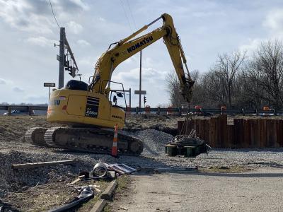
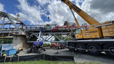
Also onsite are two 80-ton (72.5 t) cranes, six track hoes, two D6 high tracks, one man lift, one hydraulic crane, two Bobcats, one small finish dozer and two back hoes.
“Throughout the life of the project, we will be excavating 430,000-plus yards, pouring 5,500-plus yards of concrete and laying 25,000 yards of sod,” Lawrence detailed.
Despite the numerous legal and logistical obstacles, Lawrence said overall progress is on schedule, which is surely a relief to everyone in the area.
Today's top stories


