A unique park on Chicago’s Northwest side — The 606 — opened with lots of fanfare in early June.
The nearly 3 mi. (4.8 km) elevated park connects four neighborhoods — from the east in Bucktown at Ashland and Bloomingdale, to the west in Humboldt Park. The pathway has 37 refurbished or brand new bridge structures, including a suspension bridge over Milwaukee Avenue and a total of six new parks and several accessible entrance ramps.
“The 606 takes Chicago’s legacy of great parks to new heights,” according to the project Web site. “The 606 has the elevated Bloomingdale Trail as its centerpiece, connected to six neighborhood parks at ground level, a wheel-friendly event plaza, an observatory, art installations, educational programming, and other amenities. Set above city streets, it’s a new way to explore Chicago on trails for biking, running and strolling.”
The project broke ground in August 2013 under prime contractor Walsh Construction. Moira Coughlin is the 606 project manager for the Chicago Department of Transportation. The project cost was estimated at $95 million and called for the construction of a 2.7 mi. (4.34 km) multi-use path on an existing elevated railroad structure. This included the rehabilitation, relocation, and/or construction of 37 bridge structures along the path. In addition, at-grade access to the trail was to be provided every quarter mile.
The first phase opened on June 6. At this point, the Bloomingdale Trail and four of the connected parks are open and accessible. Additional parks, further arts integration, and enhanced landscaping are planned in additional phases.
The project is named for the 606 Chicago zip code prefix, and was chosen to reflect the park and trail system’s role in connecting communities. The name also reflects the site’s transportation history, a play on the tradition of using numbers to name rail lines, highways and other such transportation corridors.
The 606 is a public/private partnership between the city of Chicago, the Chicago Park District, and The Trust for Public Land, which serves as the lead private partner and the project manager on behalf of the Chicago Park District. The not-for-profit organization focuses on creating parks for people, and is overseeing civic engagement, fundraising, and land acquisition for the project. The park and trail system is funded through a mix of federal, state and local funding, as well as private and corporate philanthropy.
For Beth White, who serves as the director of the Trust for Public Land, the project has been nine years in the making, including land acquisitions, fundraising and acting as facilitator and coordinator of all of the partners.
“The Trust for Public Land is a national land organization, with the goal to have a park within a 10-minute walk of everyone in America,” White said. “We want to create parks and preserve open space. The park is within a 10-minute walk of 80,000 people, including 20,000 children. It will engage 21 schools and get students out of classroom. It’s an excellent learning opportunity about the history of city. We’re also taking The 606 into the classroom. The Trail Mix series involves learning at all age levels — covering the history of manufacturing along the lines when they were erected. It explains how industry grew up along the track. The last track was raised in 1915, and it is now repurposed for the next 100 years. It’s a history-rich suburb.”
The team noted that construction challenges included excavating, hauling, grading, placing and paving almost 3 mi. (4.8 km) of path on an elevated structure no wider than 30 ft. (9.1 m) with limited access points. Difficulty was also encountered in refurbishing and relocating an 80-ton (72.6 t), 100-year-old steel bridge structure more than 1.5 mi. (2.4 km) from Ashland Ave to Western Ave.
White explained that opening day was set for Saturday, June 6 (6-06), which also was National Trail Day. She reported that all kinds of exciting activities were planned, with many processions rather than a parade.
Speaking before the opening, she said, “We want everyone to participate, not stand back and watch. It will be a joyous day.”
White noted that park in the old railroad structure is essentially seven giant concrete bathtubs connected by bridges.
“There was a lot of engineering work and design work, and meetings with the community — we wanted to be sure the design was what the community wanted to see,” she said. “The design process involved community engagement and lots of public meetings, so there was direct interaction with designers and engineers — a lot of public input. The engineers are nothing short of brilliant in the way they collaborated, and were playful and creative with respect to the bridges and how they were treated.”
One example White noted was the Western Avenue Bridge, which was in need of repairs, and the recommendation was to demolish it and move the Ashland Bridge to replace it. This resulted in a monetary savings. On Milwaukee Avenue, the bridge deck was elevated to create a safer one at street level.
“It was a brilliant solution, and resulted from some lively conversations,” she said. “They worked with community and took their ideas and worked to incorporate them. It was a model for how landscape architects and artists can participate in the planning process.”
The new bridge at Milwaukee Avenue features arches and used recycled steel from the old bridge. The bridge was raised to provide additional clearance for trucks before the arches were installed. The bridge cables were tightened so the weight of the bridge is supported by the arch instead of the piers on the street. The center pier was to be removed to improve traffic flow on Milwaukee.
Trees were saved in a few patches along the trail, but a total of 1,400 new trees will be planted.
Lincoln Park Zoo will install small cameras to observe animals that return to the trail. The cameras will be enclosed in weatherproof cases and placed inside a few of the existing mature trees for four weeks during each season.
Subcontractors for the project included Trine Construction Corporation, Steppo, Pine Waterproofing, Midwest REM Enterprises Inc., Marking Specialists Corp., Mammoet USA North Inc., MA Steel Erectors Inc., J.E.M. Traffic Control, Ibarra Group, Homer Tree Service, Halloran & Yauch Inc., Gale Connor Sports Flooring Inc., Collins & Hermann Inc., Atlantic Painting Company Inc., Araiza Corporation, American Concrete Restoration, Aldridge Electric Inc., AC Iron and Kinsella.
Major equipment used on the job included a Mammoet self-propelled modular transporter (SPMT), a Gomaco slip-form paver, a vibratory sheet pile hammer, and various cranes and heavy equipment.
Notable quantities from the project included 28,000 sq. yds. (23,411.6 sq m) of concrete path surface; 6,300 sq. yds. (5,267.6 sq m) of athletic track surface; 367,000 sq. ft. (34,095.4 sq m) of existing concrete surface for cleaning, repairing, and restoring; 200,000 lineal ft. (60,960 m) of electrical cable; 72,000 cu. yds. (60,201 cu m) of planting soils; 1,400 shade trees; 4,800 ornamental shrubs and trees; 55,000 perennial plantings; 123,000 grasses and sedges; and 56,000 flowering bulbs.
History of The 606
After the Great Chicago Fire, the Chicago City Council gave permission for the Chicago & Pacific Railroad to lay tracks down the middle of Bloomingdale Ave. as part of their efforts to rebuild the city. It helped connect goods from outlying rail ports to the Chicago River, and supported Chicago’s industrial growth. As the population grew, thousands were injured and killed between the 1870s and 1890s due to rail crossings at ground level.
In 1893, the City Council passed an ordinance mandating that railroads elevate their tracks within six years. The Bloomingdale Line was one of the last to conform to the new ordinance, beginning work in 1910 and completing in 1913. Rail service continued uninterrupted throughout construction.
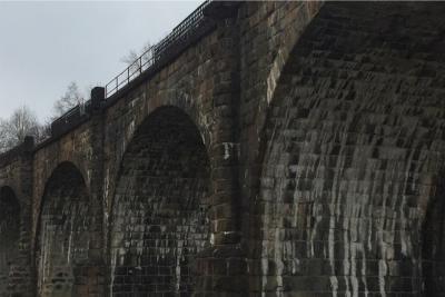
The embankments created by elevating the line are essentially enormous concrete bathtubs filled with soil, stones, and other drainage material, similar to French drains. Seven feet thick at the base, the walls have proved sturdy for 100 years, and form the foundation for the Bloomingdale Trail.
For nearly a century, the rail line served a small manufacturing district across the city’s Northwest side, including bicycle, furniture, confection, and instrument makers. Trains rolled overhead until the 1980s when activity slowed to a trickle. By the mid-1990s, the few trains that used the corridor were re-routed, and freight service ceased completely.
In the late 1990s, when train traffic slowed on the Bloomingdale Line, discussion began about how the train line might be used to increase green space. Eventually, this led to the forming of Friends of Bloomingdale Trail, which was the key to creating The 606. The Trust for Public Land hosted numerous community meetings, bringing local input into the design, function, and aesthetics of the parks, trail, and event spaces. The final design plans were formed in June of 2013.
“It’s incredibly exciting and very satisfying,” White said. “I’m thrilled at the way the community has embraced the project. I’ve never seen something like this has generated — it’s a very powerful thing in terms of how the community connected. This used to be a barrier among the neighborhoods.”
Today's top stories


