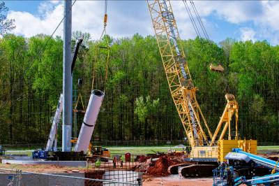
Adding 31 mi. (50 km) of new four-lane from Marshfield to Stevens Point, Wis., in central Wisconsin will not only handle the ever increasing traffic load, but improve safety, since the new stretch of expressway will bypass several communities.
The Wisconsin Department of Transportation is expanding 31 mi. of U.S. 10 between WIS 13 near Marshfield to I-39 north of Stevens Point. The new four-lane highway will bypass the communities of Auburndale, Blenker, Milladore and Junction City. The $244 million project is paid for with a combination of federal and state funding.
Of the 31 mi., only 4 mi. (6.4 km) will use the existing roadway, which will be widened. The rest of the existing roadway will stay intact as a local or as a county road, with a new name of Highway HH, explained Matt Bronson, project development supervisor with the Wisconsin Department of Transportation.
“Upon completion of the new U.S. 10 project, responsibility of the existing U.S. 10 will be transferred to townships or to counties, which will handle the maintenance. In Wisconsin, the local jurisdiction gets state road aids to maintain each mile of roadway they maintain.”
Some factors considered in defining these changes include safety, travel efficiency, system continuity and traffic volumes. The existing roadway is routed through five communities, which increases conflict points with local traffic, thus creating safety issues. U.S. 10 serves central Wisconsin as an east/west highway connecting the Twin Cities in Minnesota and the Fox Valley in Wisconsin. It is an important regional, state and national link for business, industry, recreation and agriculture, Bronson said.
The new 31-mi. stretch will handle 65mph traffic with the western two-thirds designed as an expressway with two at-grade intersections, one at WIS 34, and a system-to-system interchange with Interstate 39, creating fewer contact points, Bronson said. “The overall goal is to improve safety and efficiency and fewer conflict points of driveways and side roads. There is also a high-speed railway adjacent to the highway for the majority of the length of the road so it creates a safety issue, as well.” The changes will provide a more direct route for motorists, reducing the distance and travel time.
Currently, traffic along the old stretch of U.S. 10 is between 4,500 and 8,200 vehicles each day, but by 2030 traffic is expected to range between 9,700 and 13,500 vehicles. U.S. 10 is on the National Highway Safety System and is an important route in Wisconsin’s Corridors 2020 transportation plan, which is a long-range highway improvement plan designed to provide essential links to key employment and population centers throughout the state, according to information from WIS/DOT.
Construction, which began in 2006 and is scheduled to end in 2012, includes five new interchanges, four of which are on Highway 10 and one is on Casmir Road, on the east end of the project. The project includes 22 bridges, which includes those in the interchanges, along with some over waterways. Interchanges are located at: Casmir Road, which was completed in 2006; at Interstate 39, which was completed in 2009; at Highway 34 North, which was completed in 2008; at Highway 34 South, to be completed in 2011; and at Highway A, at the west end of the project, to be completed in 2012.
In 2006 from June through November, the I-39/U.S. 51/Casmir Road interchange was completed, including adding ramps to the existing Casmir Road overpass for local access to Interstate 39. During the summer of 2007 the Portage County interchange was closed and the ramps were removed.
With the opening of U.S. 10 bypass at Stevens Point, the majority of through traffic is expected to take the new bypass route, removing a significant amount of truck traffic from the existing U.S. 10 between WIS 34 North and Interstate 39.
From September 2006 through September 2008, a new bridge across the Wisconsin River was built north of Stevens Point, along with a new interchange at WIS 34 North, and a new free-flow interchange with Interstate 39/U.S. 51.
From August 2007 to July 2009 construction took place on a new interchange north of the Portage County X overpass to provide high-speed free-flow access from Interstate 39 to the new U.S. 10 west bypass. The existing County X interchange was permanently closed in July 2008. County X will remain as an overpass over Interstate 39 after the project is completed.
During July of 2009, WIS/DOT completed and opened the section between WIS 34 North and Interstate 39/U.S. 51.
During September 2007 work began on U.S. 10 from Long Road to River Road where a new four-lane freeway from Long Road to River Road was constructed. The project also includes an overpass at Portage County E and a new interchange with WIS 34 North. Work was completed in July 2009.
James Hoffman of Hoffman Construction, Co., of Black River Falls, Wis., prime contractor of the 2007 to 2009 four-lane road portion of the project, said the project went well with no major delays, but they did encounter some difficulties with compaction due to the high amount of clay in the soil. “It was harder to create the desired affect than we anticipated,” Hoffman said.
Hoffman Construction was also able to participate in a Madison Research Study that focused on the varying thicknesses of quality fill.
“Monitoring devices were placed to see how the varying lift fills were compacted,” Hoffman said. “It was found that the compactive effort of our loaded hauling equipment was more substantial than the rollers” when driving over the materials using varying wheel spacings. However, the specs for the project required that rollers be used for compaction rather than loaded trucks, but the findings were submitted to the Department of Transportation for further review.
During the course of this project, WIS/DOT incorporated GPS controlled grading, which is a relatively new technique for the DOT. A benefit of GPS controlled grading is a more accurate placement of fill materials, which saves time and increases contractor efficiency, Bronson said.
“We started using GPS controlled grading in 2006 with the Casmir Road interchange. We previously required actual physical staking be done and had completed several test projects to ensure accuracy. We are happy with those projects and have developed GPS controlled grading into a statewide specification.”
Hoffman added that they have eight or 10 dozers with GPS units to monitor fill and confirm fill quantities and a backhoe with a GPS unit and to monitor bucket position. GPS grading has proved to be more efficient, he added.
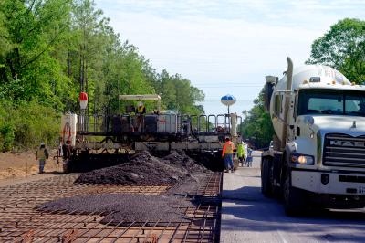
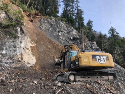
Over the course of all three projects since 2006, with the latest ending in June of 2009, about 3.6 million cu. yds. (2.7 million cu m) of soil has been moved, along with about 281,000 tons (257,900 t) of gravel and about 226,700 sq. yds. (189,550 sq m) of concrete, according to the WIS/DOT. Hoffman Construction used numerous Cat 740 off-road trucks, Mac dump trucks and Cat 345 dump trucks to haul the granular layer. Cat 631G scrapers, D9 and D10 Cat dozers and 385 backhoes also were used on the project.
Work is now progressing on the fourth phase between Portage County N and Long Road, which is near Junction City. Work is to be completed in 2011. Work will include construction of a new four-lane freeway from Wood County N to Long Road, along with overpasses at Portage County G and Portage County O, and a new interchange with WIS 34 South. After construction of U.S. 10 is complete it will be opened to traffic from Trestik Road to WIS 34 North.
During the spring of 2011 when the new U.S. 10 opens to traffic, the intersection of existing U.S. 10 and WIS 34 South will be closed and crews will construct a new WIS 34 railroad overpass and WIS 34 South interchange. The closure will require WIS 34 to be detoured for four to six months via Wood County P and Wood/Portage County O.
It is expected that about 3.24 million cu. yds. (2.5 million cu m) of soil will be moved over the next two years during this course of the project, along with about 225,500 tons (204,570 t) of gravel and about 150,000 sq. yds. (125,400 sq m) of concrete.
There are five sections of U.S. 10 still in the design stage. These sections are located between the intersection of U.S. 10 west and WIS 13, which is at the west end of the project and south of Marshfield, and Portage County N, which is near Millador in the central part of the project. CEG
Today's top stories


