


Our Main Office
Construction Equipment Guide
470 Maryland Drive
Fort Washington, PA 19034
800-523-2200
Tue November 14, 2017 - National Edition
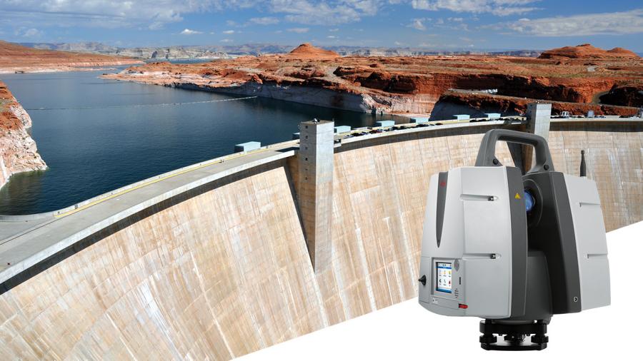
Leica Geosystems, an industry leader of measurement technology, announced the Leica ScanStation P50 3D laser scanner as the newest member of the 3D terrestrial laser scanner P-Series.
The ScanStation P50 combines all the well-known features of the P40 plus a longer-range scanning capability of more than .6 mi. Increasing users' flexibility to offer services in new markets, this rugged and versatile laser scanner enables professionals to 3D capture even at great distances with angular accuracy paired with low range noise and survey-grade dual-axis compensation, according to the manufacturer.
Professionals Can Now Scan the Inaccessible
The ScanStation P50 opens new business opportunities for reality capture professionals, helping them to scan what was previously unreachable such as big mine pits, long bridges, dams and skyscrapers. With a supreme range, the P50 enables users to scan any tall and/or wide infrastructure or dangerous sites from a remote and safe position.
The newest member of the P-Series provides the highest quality 3D data and high-dynamic range (HDR) imaging at an extremely fast scan rate of up to1 mio points per second and ranges of more than .6 mi.
"Our customers have requested increased range so that they can capture tall structures and/or far away features without sacrificing the safety of their field crews. During a recent deployment of the Leica P50 in an urban setting, the extended range allowed us to capture more of a city skyline in less setups," said Mike Harvey, Leica Geosystems NAFTA HDS product and applications manager. "Due to the extended range, the additional data made scan registration very easy and much faster."
For more information, visit http://leica-geosystems.com/scanstation_p50.
Construction Equipment Guide
470 Maryland Drive
Fort Washington, PA 19034
800-523-2200
Construction Equipment Guide covers the nation with its four regional newspapers, offering construction and industry news and information along with new and used construction equipment for sale from dealers in your area. Now we extend those services and information to the internet. Making it as easy as possible to find the news and equipment that you need and want.
Contents Copyrighted 2024, by Construction Equipment Guide, which is a Registered Trademark, registered in the U.S. Patent Office. Registration number 0957323. All rights reserved, nothing may be reprinted or reproduced (including framing) in whole or part without written permission from the publisher. All editorial material, photographs, drawings, letters, and other material will be treated as unconditionally assigned for publication and copyright purposes and are subject to Construction Equipment Guide’s unrestricted right to edit and comment editorially. Contributor articles do not necessarily reflect the policy or opinions of this publication.
Read our privacy policy here.
Mastodon