Crews are replacing a bridge along Tamiami Trail, not because its condition has deteriorated, but because it’s causing environmental problems. To solve the problem, the aim of this project, explains Donna George, U.S. Army Corps of Engineers program manager, is to improve the water flow through the slough into Everglades National Park (ENP).
The Tamiami Trail consists of the last 275 miles (442 km) of US 41, connecting Tampa with Miami. Construction of the original roadway commenced in 1916, after Miami’s Capt. James Jaudon proposed a road to connect Florida’s Gulf and Atlantic coasts, reportedly to boost development of his properties in the Everglades. The origin of the Trail’s name has been variously attributed to E.P. Dickey, on the Tampa Board of Trade, for his suggestion of “Tamyami” and to a contraction of “Tampa” and “Miami.”
Considered a feat of engineering, the Trail was under construction for a dozen years. Crews endured swampy, boggy, humid and buggy conditions while dynamiting rock that was hauled off by oxcart. The budget reached $8 million and when the state ran out of money, Barron Collier, a Florida businessman and millionaire, bankrolled the project.
Largely bypassed these days due to alternate highway routes, the Tamiami Trail is reminiscent of days past, filled with both alligators and tourist traps. However, the damage done to the Everglades lingers on. The roadway and the Tamiami Canal act as a dam, blocking water flow from Lake Okeechobee to Florida Bay at the southern tip of the peninsula.
The diminished water flow has produced a devastating effect on the region’s ecology. To alleviate the problem and help regulate water flow, in the 1990s the U.S. Army Corps of Engineers filled some canals and added culverts under the highway. Realizing this didn’t solve the problem, as early as 2003, the Corps began reviewing plans to rebuild U.S. 41/SR 90 and construct a 3,000-ft.-long (914 m) causeway near the Northeast Shark Slough north of ENP. The proposed causeway has been named the Everglades Skyway by the Sierra Club, Audubon Society and World Wildlife Fund.
Legal Obstruction
The Tamiami Trail Modifications project is one of four components of the Modified Deliveries to Everglades National Park Project approved by Congress in 1989. Mod Waters, as it is known, is intended to “restore to the extent practicable the natural hydrologic conditions within ENP,” according to the report.
As a result of the changes to the hydrologic conditions brought about by the Tamiami Trail, L-29 Canal and several levees, extensive loss of the deepest, longest hydroperiod habitat inside ENP has occurred. In addition to reducing flows, the Trail shortened the period of inundation (the hydroperiod). Because some of the land that was not then part of ENP was destined for agriculture, this “draining” was looked upon favorably in the past. However, the 1989 Everglades Protection and Expansion Act changed the purpose of lands east of the S-333 and the L-67 Extension Levee from agriculture and private ownership to the National Park Service. At that time, it directed the USACE to restore the eastern Everglades’ hydrology to the extent practicable.
The Mod Waters project plans to create hydraulic conveyance capacity through the Tamiami Trail to allow a return to a more natural flow of water and prevent loss of and restore the ridge and slough vegetation through increased volume of water delivered to North East Shark River Slough. A benefit of the plan is the anticipated reduction in highway-caused mortality of animals moving across the Tamiami Trail.
A plan approved in the 2005 Revised General Reevaluation Report to determine additional, less costly alternatives for restored water flow was reanalyzed. The revised plan includes construction of a 1 mi. (1.6 km)-long bridge 2 mi. (3.2 km) east of the intersection of Tamiami Trail and Krome Avenue, which would allow water levels in the L-29 canal to reach 8.5 ft. (2.5 m). The roadway would be reinforced to mitigate potential impact of the increased water level.
Everglades National Park Superintendent Dan Kimball approved of the plan, considering it a “major step forward” in restoring more natural hydrologic conditions in the Northeast Shark River Slough to the benefit of wildlife and vegetation. Similarly, Department of Environmental Protection Secretary Michael Sole also believes in the importance of restoring a more natural flow of water to the south Florida ecosystem, adding that it will revive the habitat of more than 60 threatened and endangered species.
Not everyone in the area is in favor of the plan, however. The Miccosukee Indian Tribe filed a lawsuit, alleging that construction of the bridge could result in flooding. In fact, the project would remove a downstream flooding constraint. Because it’s the deepest flow, the ENP segment of the Shark River Slough requires higher average water stages and longer flooding durations to restore and maintain slough habitat. Restoration of seasonal flooding along with additional freshwater flows would enhance suitability for native vegetation and at the same time decrease the potential for invasive species colonization, resulting in increased quality and quantity of ridge and slough habitat.
In June, a federal judge set aside an injunction issued the previous year, clearing the way for work to begin, with certain constraints: traffic must be maintained with minimal disruptions and no additional damage to the roadway; socioeconomic impacts on local businesses and residents must be minimized; endangered species must not be adversely affected; degradation of water quality in ENP and contributing water bodies within the basin must be avoided; and construction must begin before 2010.
Contract Awarded
Kiewit Southern Co., Tampa, Fla., was awarded the $81 million contract. The original cost was projected to be $200 million in 2008, but George explains that the economic downturn reduced the cost of material significantly, resulting in substantial savings.
In keeping with the requirement to begin construction before the new year, notice to proceed was issued on Nov. 11, 2009, reports Dennis Bahls, Kiewit project manager. Completion of the 1,287-day contract is expected in 2013. To stay on schedule, crews will work multiple shifts five days a week. Bahls anticipates some six-day weeks to make up time as necessary along the way.
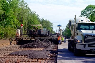
In addition to building a 1 mi.-long pile-bent bridge and the approaches, Kiewit will raise and reinforce an additional 9.7 miles (15.6 km) of roadway along the Trail to allow for higher water levels in the adjacent canal. The milling and resurfacing of the existing roadway is being performed concurrently with the new alignment work. Approximately 19 in. (48.2 cm) of existing grade is being cut out and replaced with new stabilized subgrade. Some of the excavated subsoil is being used to build the embankment.
Bahls estimates that 80,000 cu. yds. (61,164 cu m) of fill will be needed just for bridge approaches. In addition to owner-furnished borrow for the embankment, he anticipates needing more truckloads of fill. The bridge also will require about 9,500 cu. yds. (7,263 cu m) of concrete for the super structure, plus more for the cast-in-place caps and decks. Its 42-in. (106 cm) concrete deck will provide space for two lanes and shoulders. Luckily, the concrete is being supplied by a plant at the east end of the job only seven miles away.
The low-level bridge, which will sit 8 in. (20.3 cm) above water at its lowest point, will look like a causeway. Fishing boats will be able to cross under portions of it, but there won’t be sufficient space for airboats or sailboats. When completed, the bridge will feature seven 24 by 24 in. (60 by 60 cm) concrete piles 50 ft. (15.2 m) long, 80 Class 4 beams with 80-ft. (24.3 m) spans between the piers.
Manpower, Machinery … and Mosquitoes
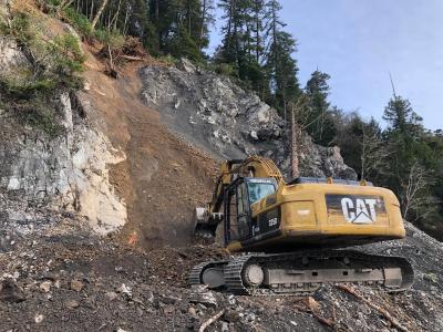
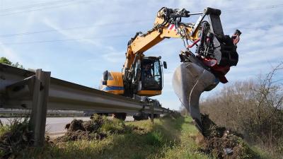
Roughly 18 to 20 subs will be onsite during the project. Equipment on the job is pretty standard, Bahls said: excavators, 12 to 14 size Cat motorgraders, dozers and vibrating rollers. “The excavators are long stick 400 – 100,000 pound machines, but there’s not a lot of specialized equipment.”
In fact, he said, the bridge and roadwork on the project aren’t unusual, but “the geology is. It’s our toughest challenge.” Because the bridge is next to the road, crews have been clearing and grubbing (trees). They will push traffic away from the bridge, shifting lanes in order to put up concrete barriers to create a work zone and allow temporary access to the embankment. “It’s a long, narrow job without much right of way. We don’t want to impact the public, but there’s quite a bit of local traffic. We can’t shut it down, but we are allowed to close half of the road and isolate work zones.” Crews will set beams during non-peak traffic times so they can close a lane for extra room. Lane closures will be alternated with flaggers during off-peak times when they begin paving.
To ease traffic congestion related to construction, George said message signs will be placed in advance of lane shifts and information about changes affecting traffic will be disseminated via radio and other media. Different public outreach approaches are being employed, explains USACE’s Outreach and Communication Manager Nanciann Regalado, because it’s not a residential area. Due to the fact that the roadway between west Miami and Naples is used predominantly by tourists rather than by commuters, signage is key. But, Regalado notes, so far work has not had a big impact on traffic. “There have been no long delays.”
Bahls hopes there won’t be any long delays with construction either. Weather can impact progress in southern Florida. He worries about rain and hurricanes, but said he’s concerned about “lightning even more than rain.”
In addition to challenging weather, the surrounding environment poses some challenges of its own. “It’s a very environmentally sensitive area,” Bahls says. “You have the canal, the Everglades and wetlands. We don’t want to create any issues, so we’re using best practices.” That includes use of a silt curtain designed specifically for marine use to prevent water pollution. Typically, these barriers contain and control the dispersion of turbidity and silt in a body of water relative to marine construction, dredging or environmental remediation. Dust control is another big challenge, he notes.
Crews are taking precautions with the equipment to ensure it doesn’t “drip,” Bahls said, monitoring for leaks and protecting against spills. They’re also monitoring wildlife in the area. “There are restrictions regarding the wood stork, indigo snake, snail, manatee… We can’t work in some areas during certain times of the year due to nesting.” Crews also are on the lookout for other types of wildlife, for other reasons. “We have a lot of inside jokes about alligators, mosquitoes, snakes and pythons.”
Although the project is still in the early stages, Bahls said things are going well and they expect to finish on time. He doesn’t anticipate any surprises. “We bid in November 2008,” he points out, “so we’ve had a lot of time to think and plan. We haven’t encountered any surprises yet.”
Kirk Fordham, CEO of the Everglades Foundation, said in a press release that there are “few projects as important to the recovery of the Everglades and Florida Bay as the bridging of Tamiami Trail.” After years of planning, he is “overjoyed” to see construction begin — a sentiment echoed by Bahls as he looks forward to a three-and-a-half year project in the Florida Everglades.
Today's top stories


