
Hexagon AB, a global leader in digital reality solutions, announced the introduction of the Leica BLK ARC and the Leica BLK2FLY, extending its BLK series.
The autonomous reality capture solutions are the latest innovations in Hexagon's comprehensive portfolio of accessible, easy-to-use digital reality capture sensors.
The Leica BLK ARC is a laser scanning sensor purposely built to improve the autonomous navigation of robots and other carrier platforms to deliver fully autonomous mobile laser scanning.
Combining its speed, accuracy and versatility with robotics, the BLK ARC addresses the growing demand for autonomous solutions that can safely and repeatedly capture accurate 3D point clouds and panoramic images of changing environments with minimal user intervention.
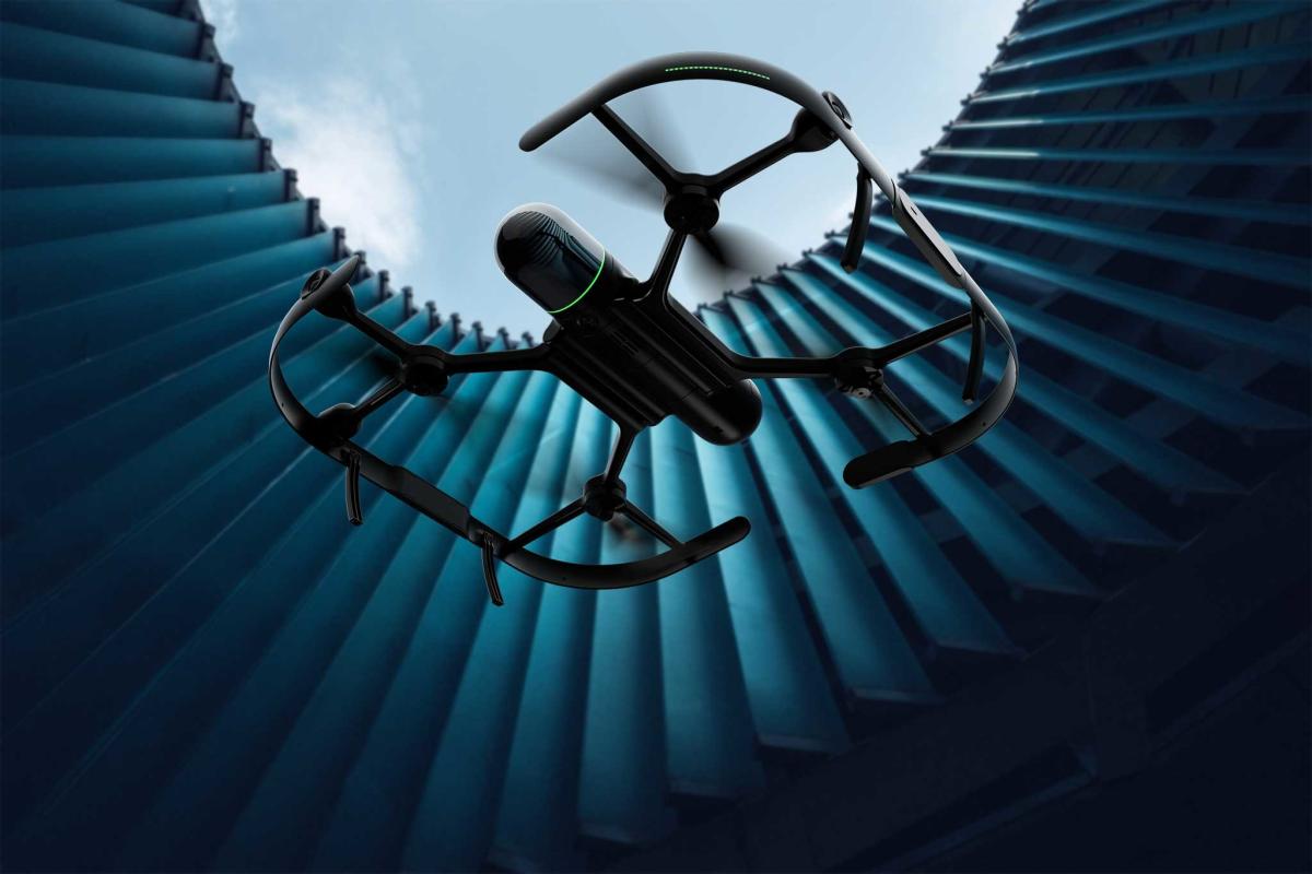
The Leica BLK2FLY is the world's first fully integrated, autonomous flying laser scanning sensor. With a few simple taps on a tablet, users can quickly and easily scan structures and environments accurately and entirely from the air.
The airborne scanning provides value across multiple industries in need of accurate data of inaccessible or hard-to-reach areas (e.g., façade projections, rooftops), ensuring complete capture of a structure's exterior features and dimensions.
The BLK ARC and BLK2FLY connect directly to Hexagon's cloud-based visualisation platform, HxDR, where immediate data upload from the field, AI-enabled cloud processing and storage of the captured data enables instant delivery of a purpose-built smart digital reality to anyone who needs it.
"The BLK2FLY and BLK ARC illustrate Hexagon's commitment to empowering an autonomous future with smart digital realities. The purposefully integrated sensor-software systems are tailored to bring autonomous agility and speed to any reality capture workflow," said Hexagon President and CEO Ola Rollén.
"The robots, sensors and software work together, dynamically adjusting reality capture missions to offer seemingly limitless business applications —from as-built site documentation for buildings to monitoring and situational awareness of remote or hazardous environments, such as mines, factory floors, off-shore facilities, fire investigations and more."
While the first robotic compatibility for the BLK ARC is with the Boston Dynamics Spot, it can be easily integrated with other autonomous robotic carriers.
Enhancing Spot with autonomous reality capture technology, the BLK ARC delivers, for the first time, fully autonomous mobile laser scanning specifically designed for robots. Spot carries the BLK ARC through an environment while the BLK ARC improves Spot's navigation while capturing 3D data. The combination provides Spot greater autonomy with accurate laser scanning and navigation, enabling users to safely build 3D models of any area the robot can go, the manufacturer said.
The BLK2FLY introduces the next generation of flight safety with advanced autonomous obstacle avoidance. Sensor fusion of LiDAR, radar, cameras, and GNSS ensures optimal and safe flight paths. Users can seamlessly combine data from the BLK2FLY with interior scans of buildings and structures captured with the Leica BLK2GO, Hexagon's handheld 3D scanner. The resulting colorized 3D point clouds are instrumental to building information modelling (BIM) processes, including documenting site conditions.
Both solutions were introduced at "The Age of Autonomy – The Next Evolution of BLK," at BLK2021.com.

BLK ARC scans autonomously from the ground and can automatically repeat the same scan for up-to-date 3D data every step of the way.


